Benefits
Ecopia provides detailed layers of individually classified land cover features derived from geospatial imagery, attributed with important information such as width, material, and building height.
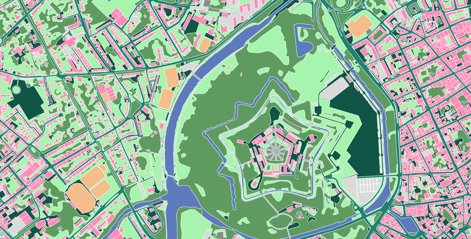
Ecopia's AI-based technology extracts land cover features from high-resolution imagery with >95% geometric accuracy, providing an unparalleled digital source of truth for the physical world.
Ecopia's partner network of leading geospatial imagery providers captures high-resolution imagery every year, enabling us to detect change and deliver annual updates of our 3D Land Cover data.

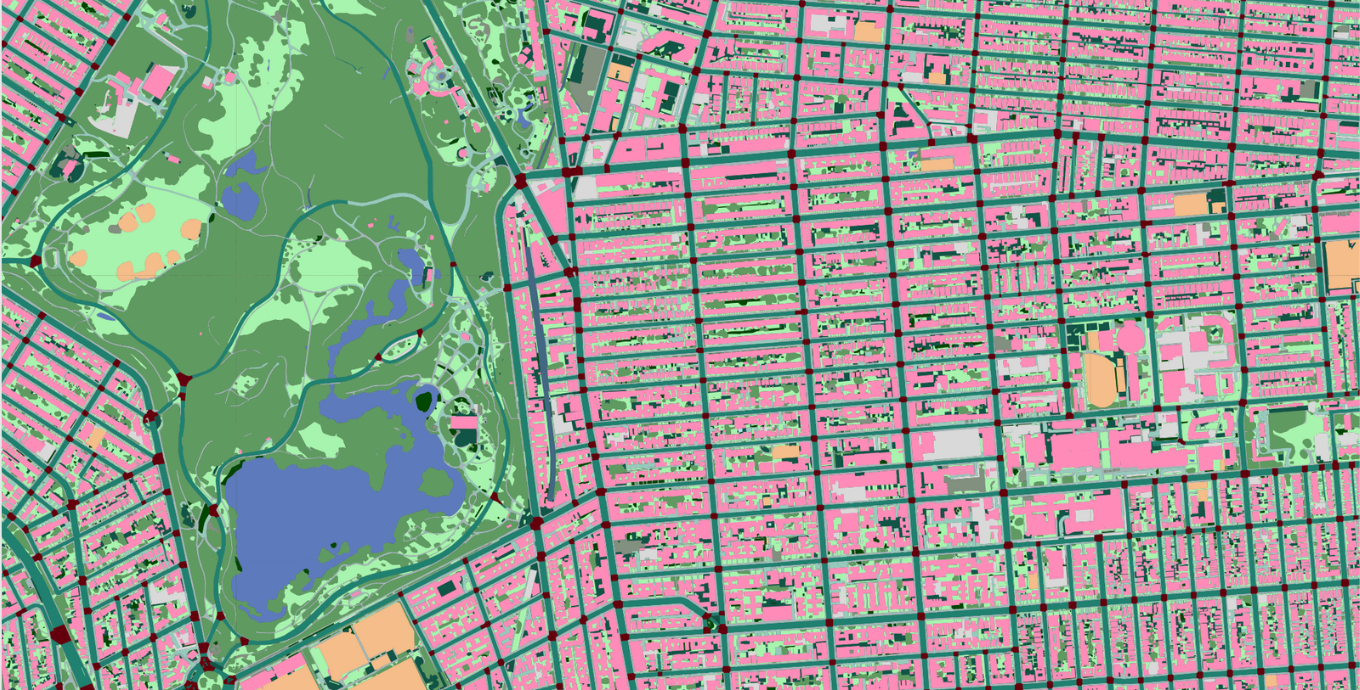
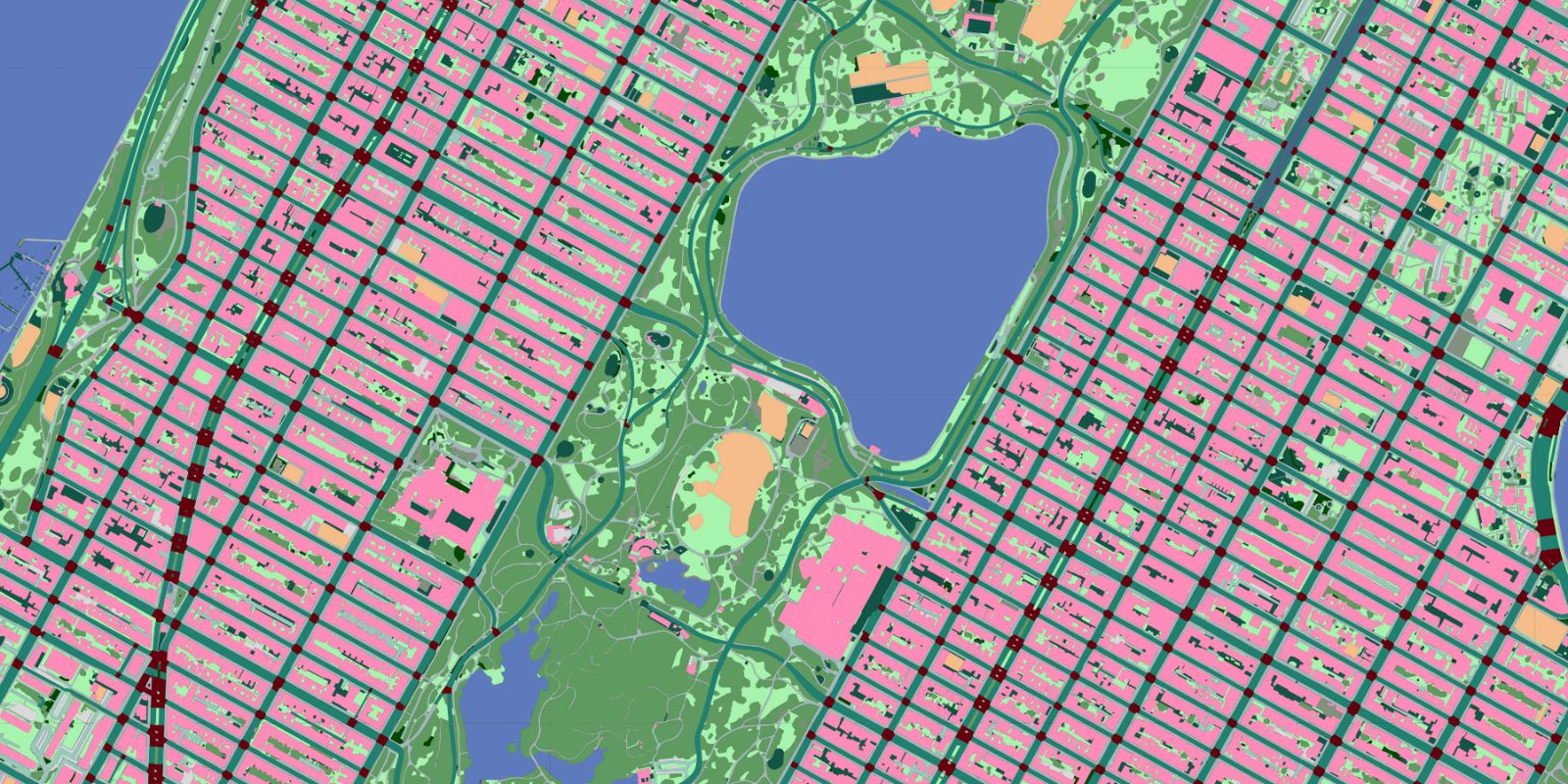
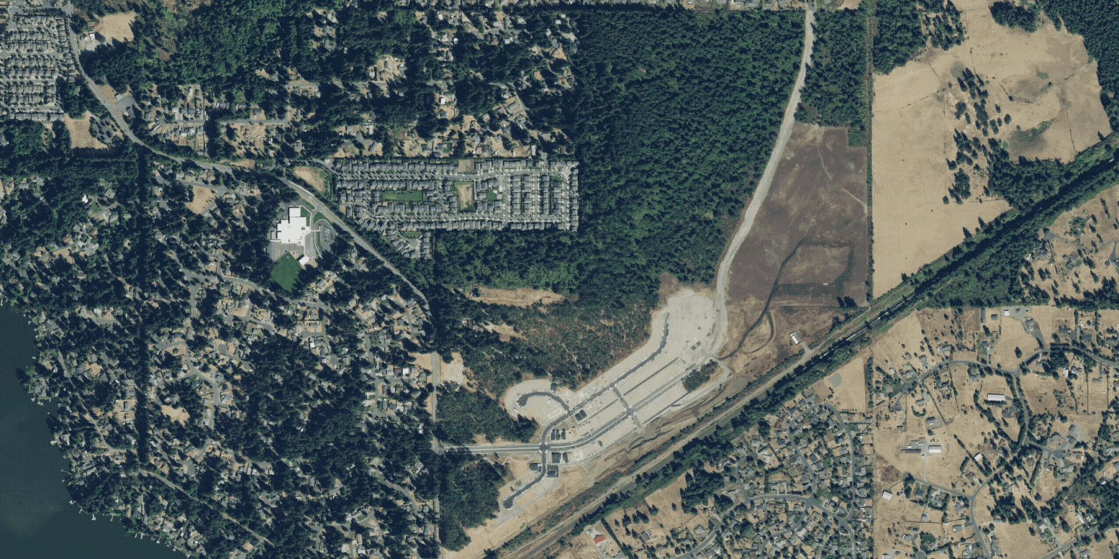
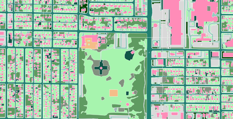
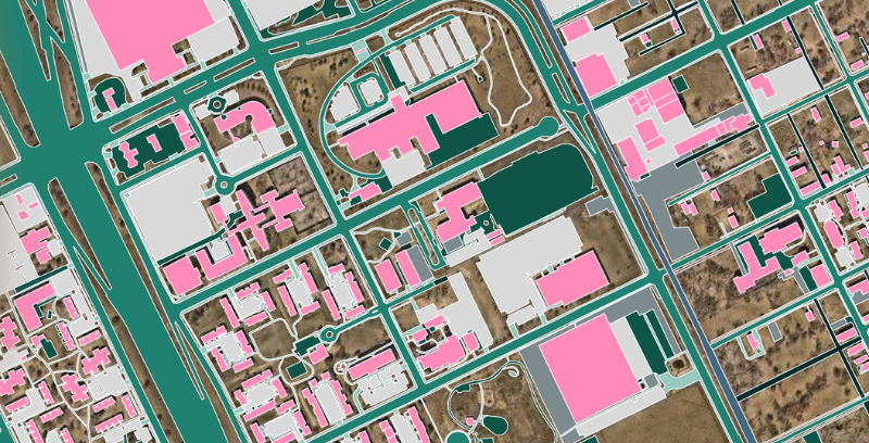
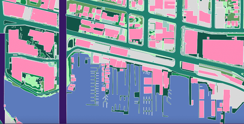
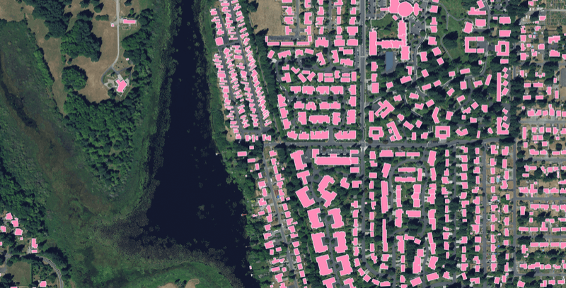
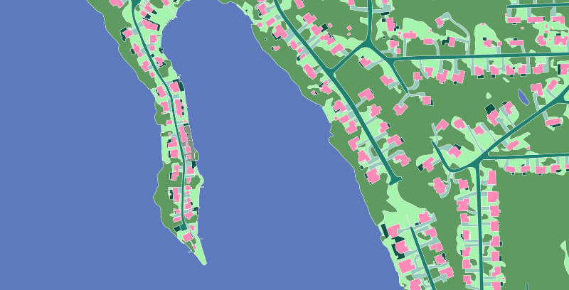
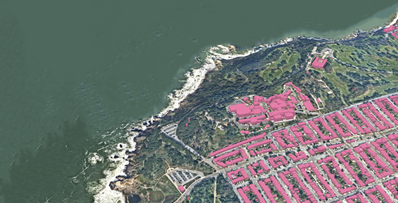
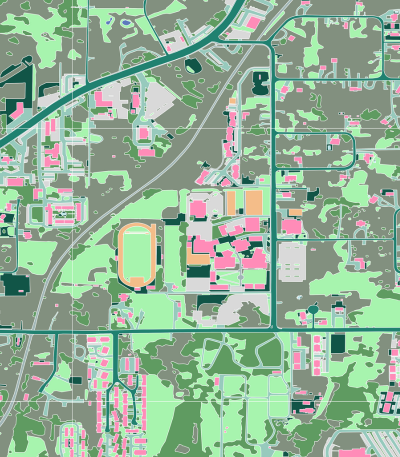
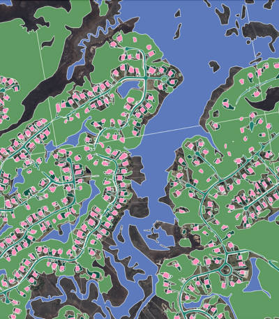
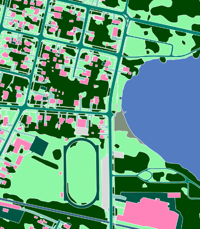
Planimetric land cover and land use data
2D foundational layers
Ecopia's AI-based mapping systems detect and extract land cover features captured in our input imagery, whether natural or manmade, and classify the results into distinct layers depicting critical landscape elements and infrastructure.
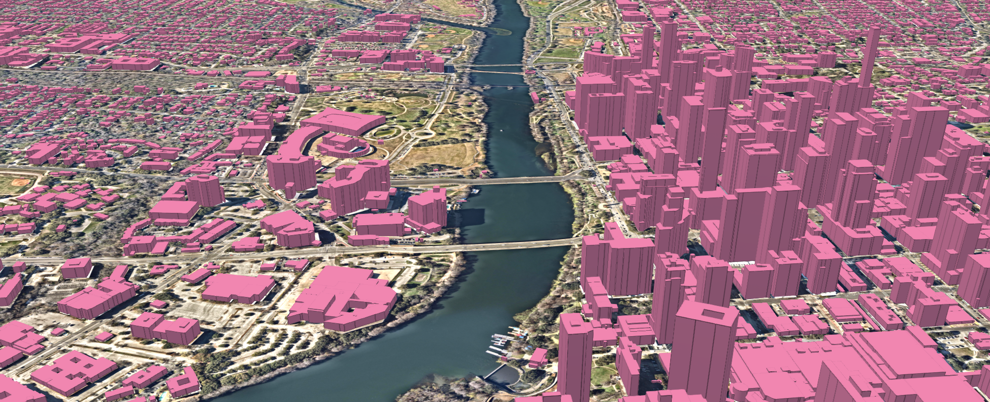
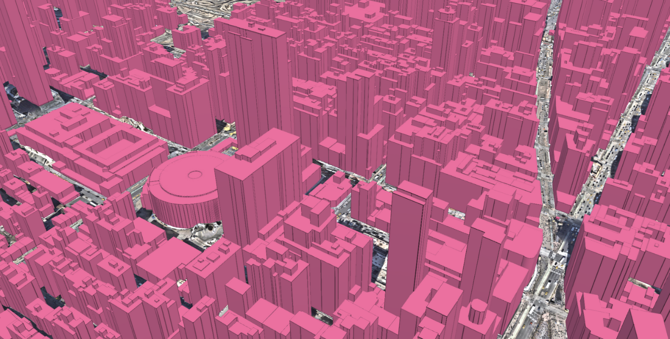
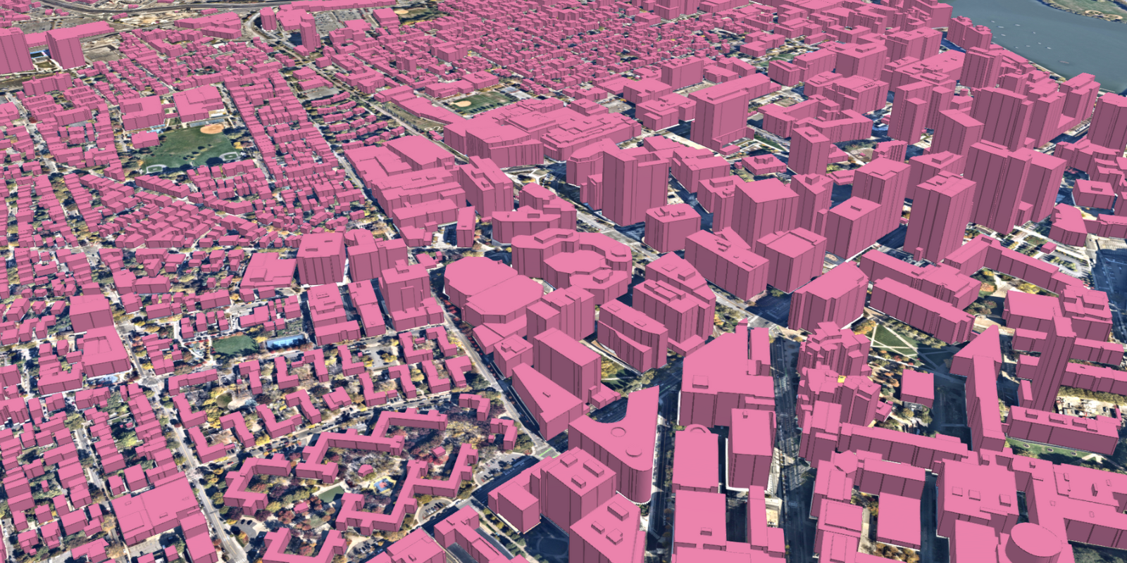
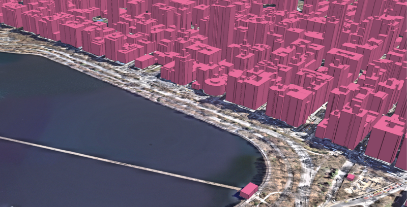
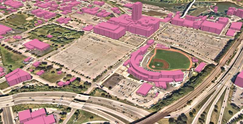
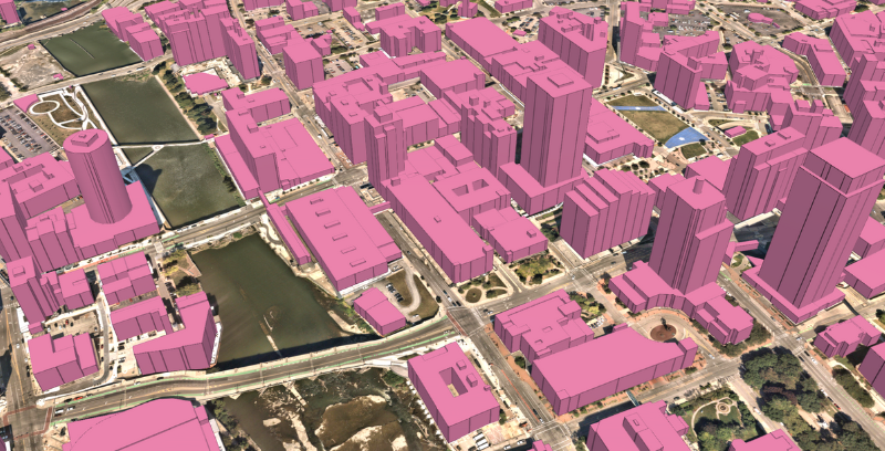
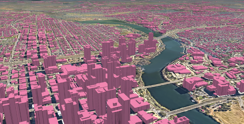
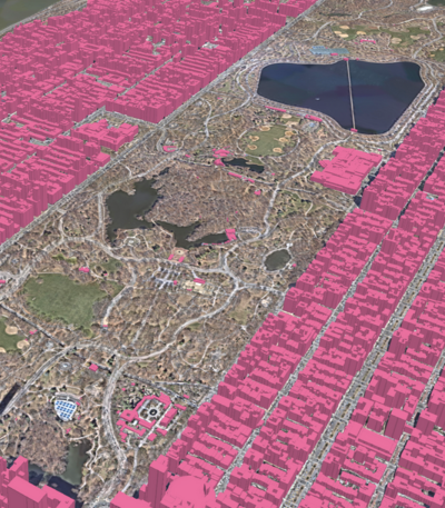
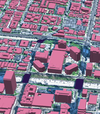
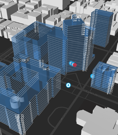
3D buildings
Using our advanced AI-based feature extraction, we derive and append unique height attribution for all buildings, delivering a 3D representation of the physical world.
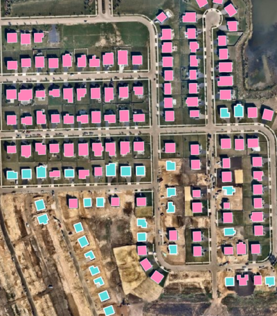
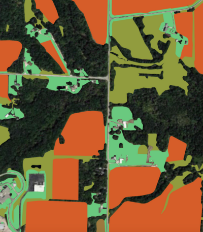
Change detection
Every year, Ecopia leverages our partnerships with leading geospatial imagery providers to source fresh high-resolution imagery. This imagery is mined using our AI-based systems, resulting in an annual update of land cover to deliver map content with the latest real-world data.
Urban Planning
Leverage high-precision, up-to-date land cover map layers to understand existing infrastructure and develop plans to meet client project goals.
Stormwater Consulting
Help clients develop resilient stormwater management strategies by informing SUF programs and infrastructure plans with detailed impervious surface data.
Stormwater Management
Improve flood models, climate resilience strategies, and stormwater infrastructure with high-precision land cover data detailing distinct types of pervious and impervious surfaces.
Public Safety
Empower emergency services and next-generation 911 systems with accurate 3D maps of buildings, roads, and driveways to support precise identification of caller location and dispatch planning.
Climate Resilience
Leverage a comprehensive understanding of land use for hazard mitigation, green infrastructure planning, conservation efforts, and environmental monitoring.
Infrastructure Planning
Develop, expand, and improve infrastructure with a detailed understanding of land cover and land use.
Network Planning & Deployment
Harness a digital representation of the real world to better plan and deploy networks and optimize service areas.
Regulatory Compliance
Automate the identification of broadband serviceable locations and meet filing requirements.
Hazard Exposure
Gain a comprehensive understanding of exposure to natural hazards through high-precision property intelligence.
Property Analytics
Visualize your portfolio in 3D to understand how height and other physical characteristics impact its risk profile.
Trusted by industry leaders
Ecopia was able to quickly create the baseline data at a price point that was unmatched. The labor cost would be three times as much as it was if we hadn't partnered with Ecopia, and would have resulted in significantly greater expenses for our client.

Partnering with Ecopia has enabled us to efficiently develop an authoritative database of critical land cover and infrastructure across the greater Tucson region. Ecopia’s AI-based systems are able to produce the data we need at an unprecedented scale.

No other data provider could match Ecopia’s accuracy or efficiency in feature extraction, and we are looking forward to equitably enhancing our community’s stormwater program with the addition of this foundational data.

I cannot emphasize enough how much time Ecopia saves us. It took four years to build our previous dataset which quickly became stale and needed updating. Each year, Ecopia is able to extract the features we need in just a few weeks, ensuring we always have a fresh database for emergency response planning.

Ecopia’s ability to create a high-accuracy product was critical, but their ability to maintain the dataset is what really differentiates them from our previous efforts. DWSD is able to rely on the interpretation not changing year over year and thereby minimizes staff resources to integrate the product into our workflow. This directly translates into a cost and time savings.

The need for accurate information on buildings and the surrounding landscape data is more pressing than ever. By partnering with Ecopia, we can rapidly build a comprehensive and reliable database of building footprints and their surrounding environment. This will be instrumental in supporting our efforts to protect communities, secure infrastructure, and preserve valuable resources across California.

Ecopia’s ability to create unique detailed, accurate mapping layers at scale and with speed is key. The data is a fundamental and innovative step in the fight against climate change, flooding, threatened public access to natural resources, habitat loss, storm preparedness and recovery, and vulnerable infrastructure and populations.

The partnership with Ecopia empowers us with an unprecedented level of detail and accuracy about northeastern Illinois. These comprehensive and up-to-date views of transportation and land cover will help CMAP and local decision makers drive innovation and develop projects that serve our region’s 8.5 million residents.

Learn more about 3D Land Cover
News
Climate Resilience
The California Department of Forestry and Fire Protection Selects Ecopia AI to Deliver High-Precision Mapping Data to Support Fire Mitigation and Response
News
Digital Twin
3D Land Cover Data from Ecopia AI Now Available for Instant Access Across 400 US Cities
News
Digital Twin
Ecopia AI Provides High-Precision Mapping Data for NVIDIA Earth-2 Climate Digital Twin Cloud Platform
Blog
Digital Twin
The Ultimate Guide to Change Detection Mapping
News
Climate Resilience
High-Resolution Land Cover Data From Ecopia AI Now Publicly Available Through NOAA
Blog
Digital Twin
Top 5 Reasons Why You Should Stop Manually Digitizing Data

News
Digital Twin
Ecopia AI Launches New Agricultural Land Use Data Layers
Blog
Climate Resilience
Developing a Geospatial Dam Inventory with AI-Based Mapping

News
Public Safety
Ecopia Partners with NextNav to Enable Emergency Response Teams with 3D Visualizations
Blog
Climate Resilience
Top 10 Applications for Land Cover and Land Use Data

Blog
Climate Resilience
Impervious Surface Mapping Examples for Stormwater Analysis
Ready to get started?
Get in touch with our team and explore our data portal.