Data Portal
Request access to browse Ecopia's entire off-the-shelf data library


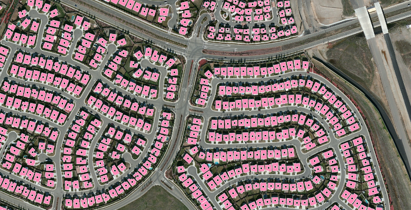
High-precision AI mapping
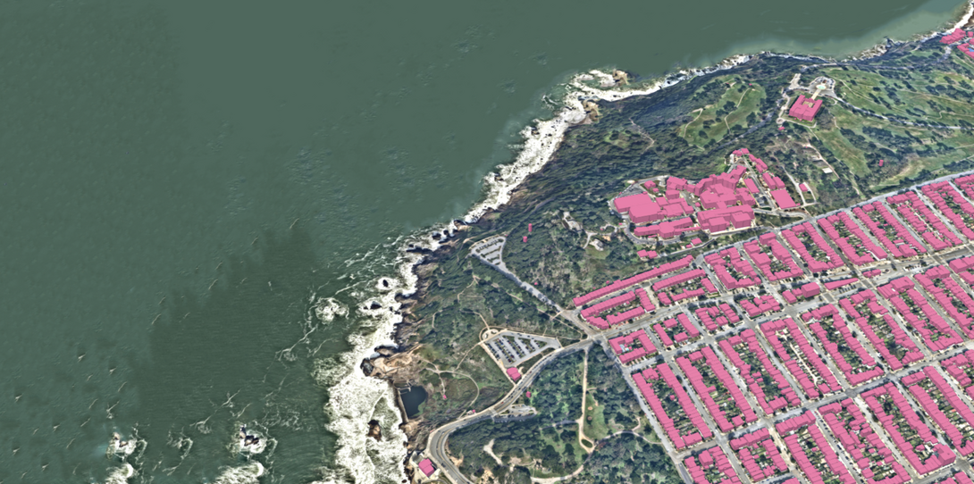
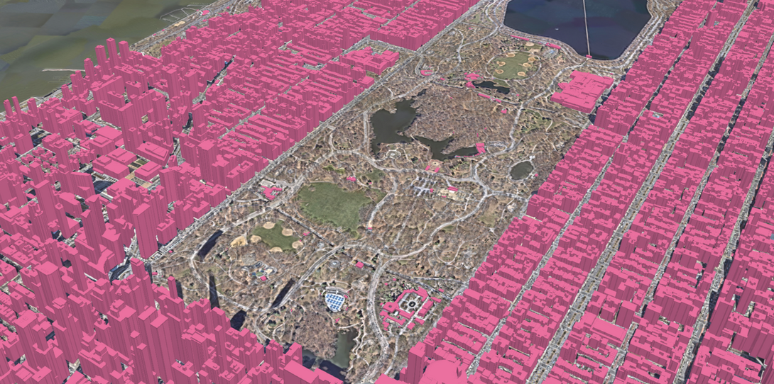
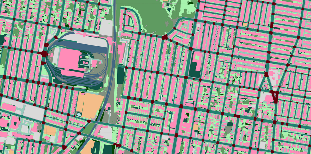
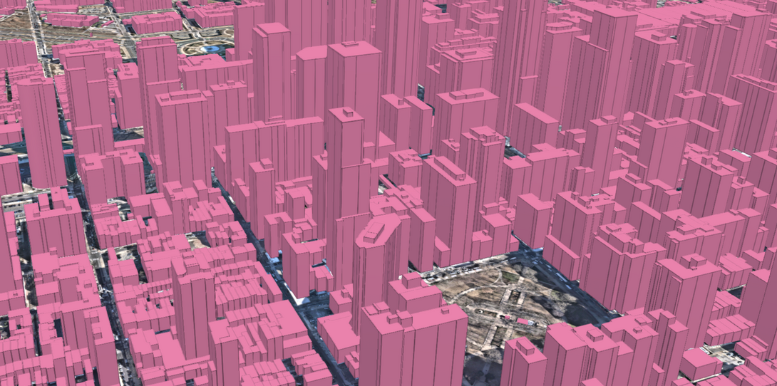
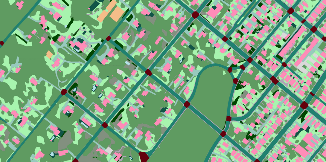
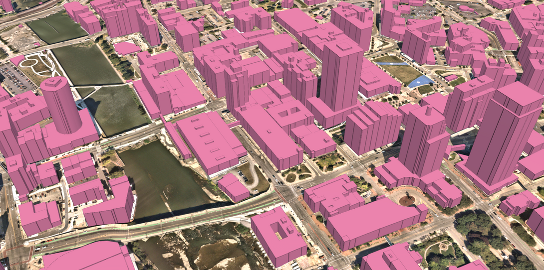
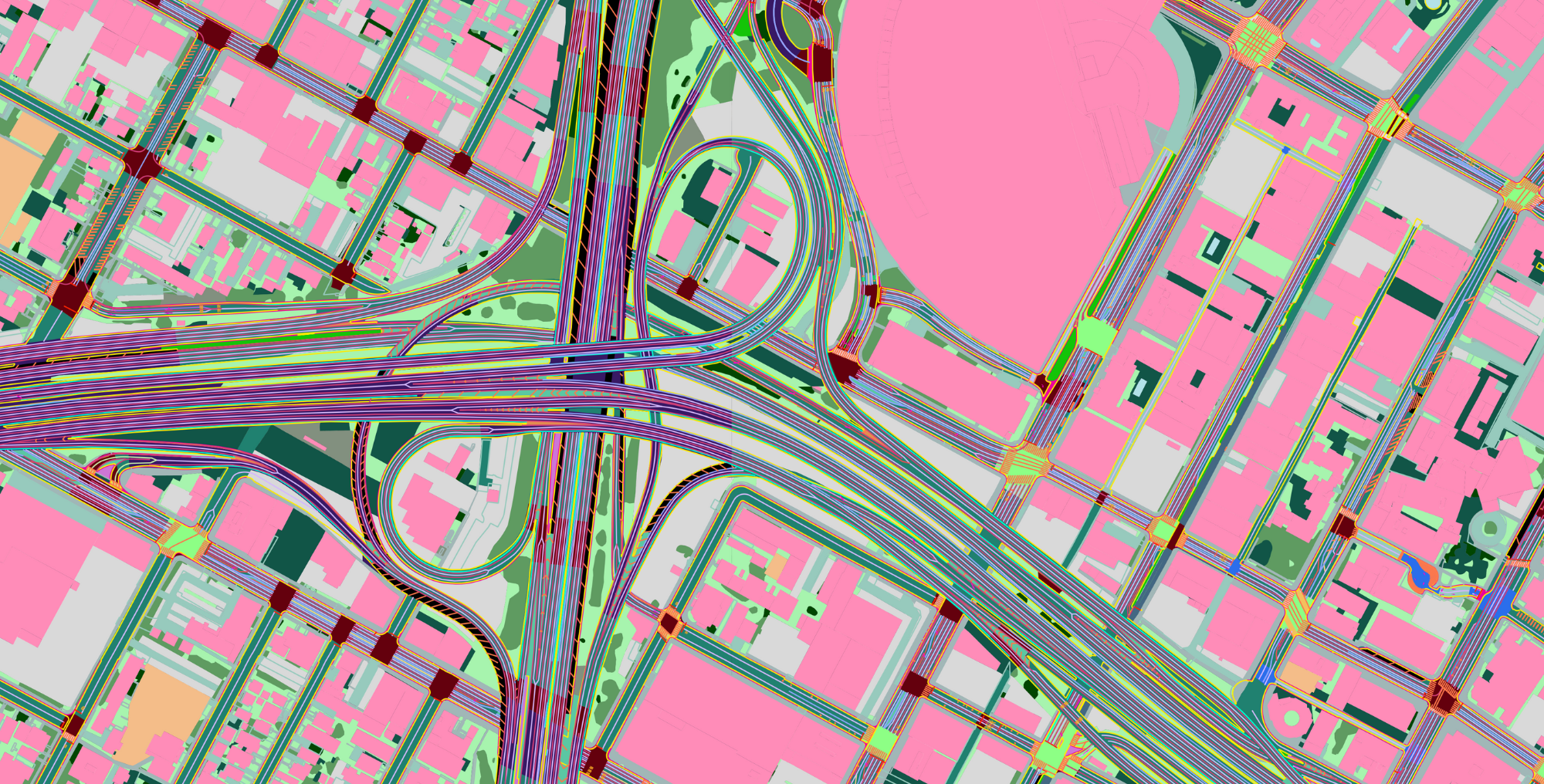
Refined over the past 10+ years, Ecopia’s AI-based mapping systems have created the foundation of a digital twin by extracting vector features at scale from the latest geospatial imagery. Over 75 layers of comprehensive, accurate, and up-to-date 3D and 2D mapping data are now available for instant access to power visualizations, analytics, and decision-making in land use planning, risk assessment, infrastructure development, and more.
Leverage the power of AI
With AI, there's no need to devote hours to manual digitization. Explore Ecopia's off-the-shelf data library or submit your own imagery for custom feature extraction to start using AI-powered data with >95% geometric accuracy.
Learn more about our datasets
-
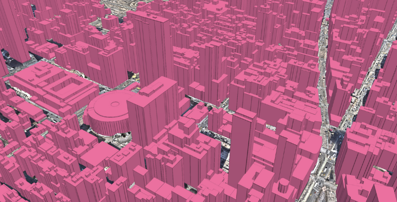
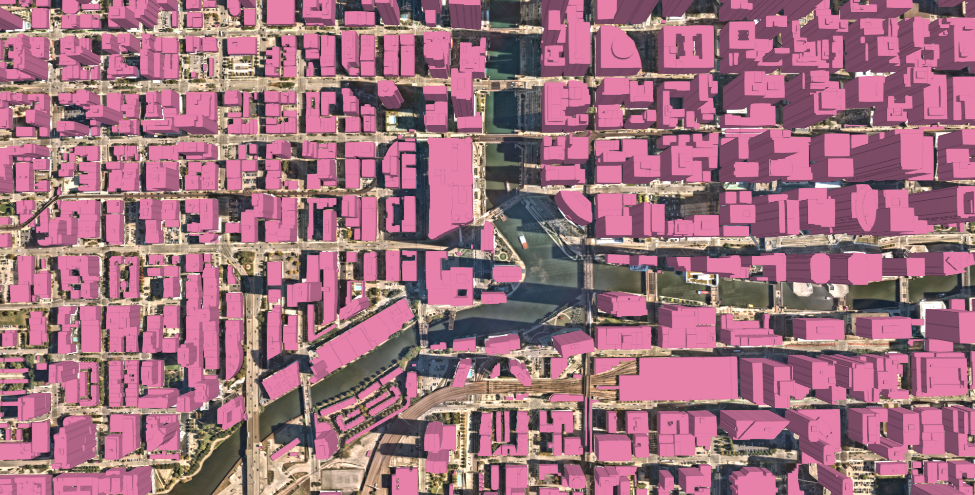
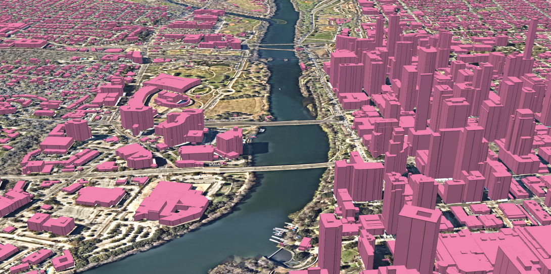
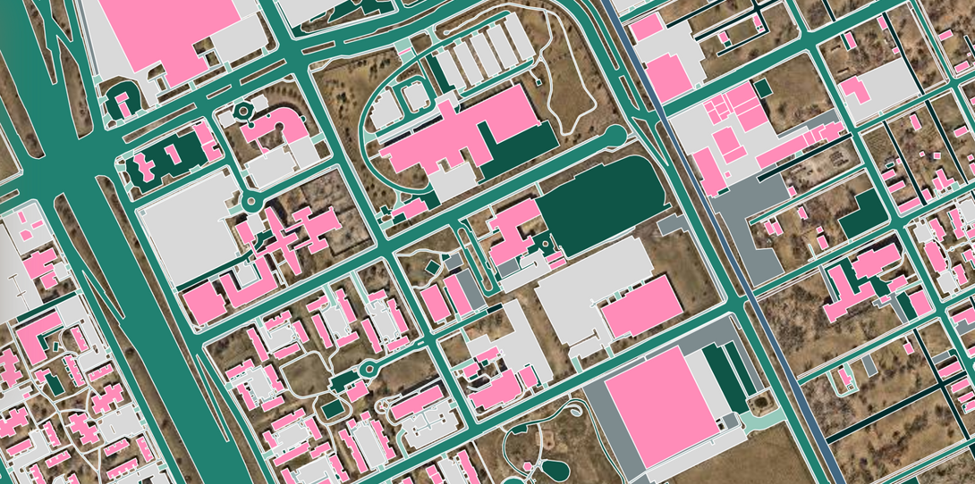
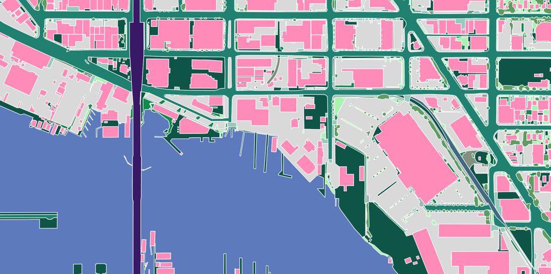
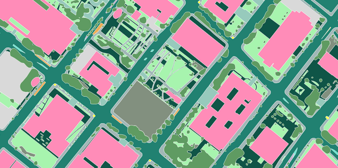
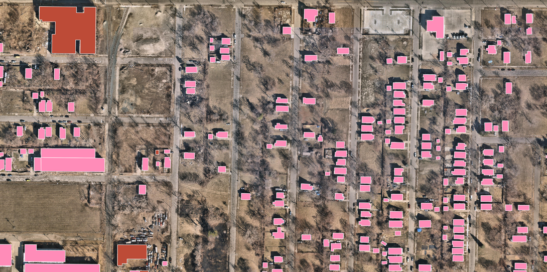
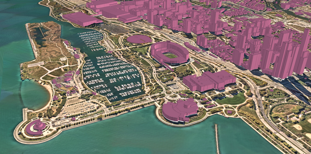
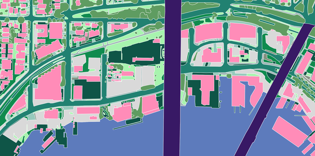
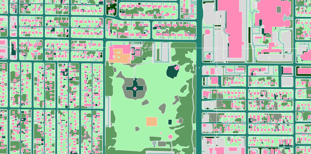
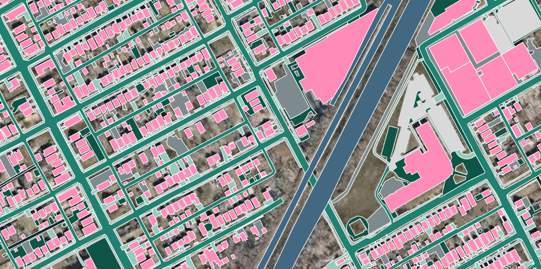
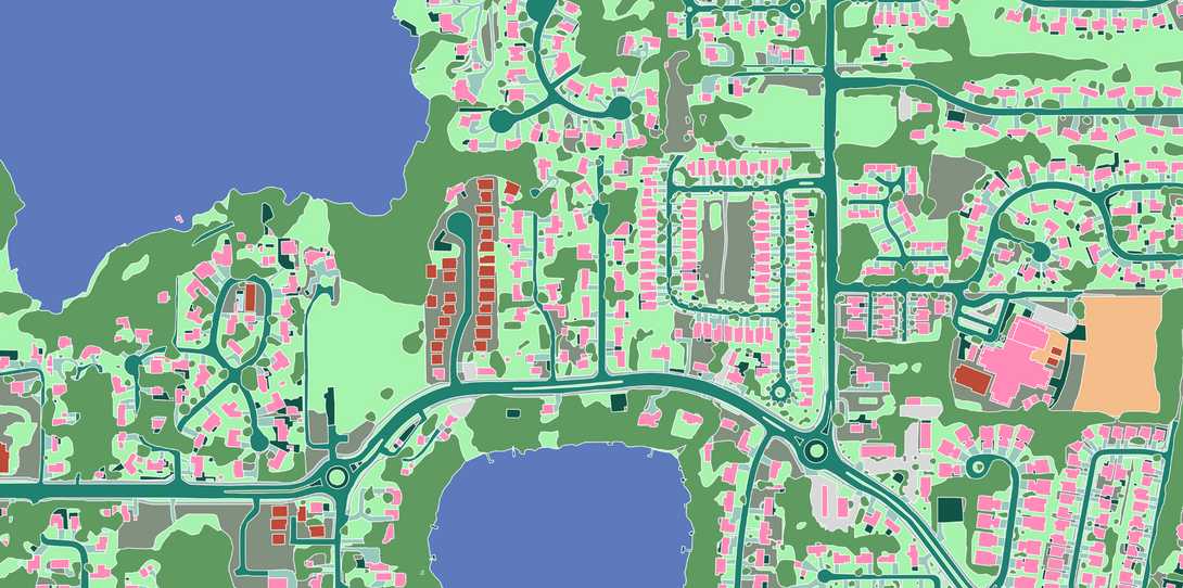
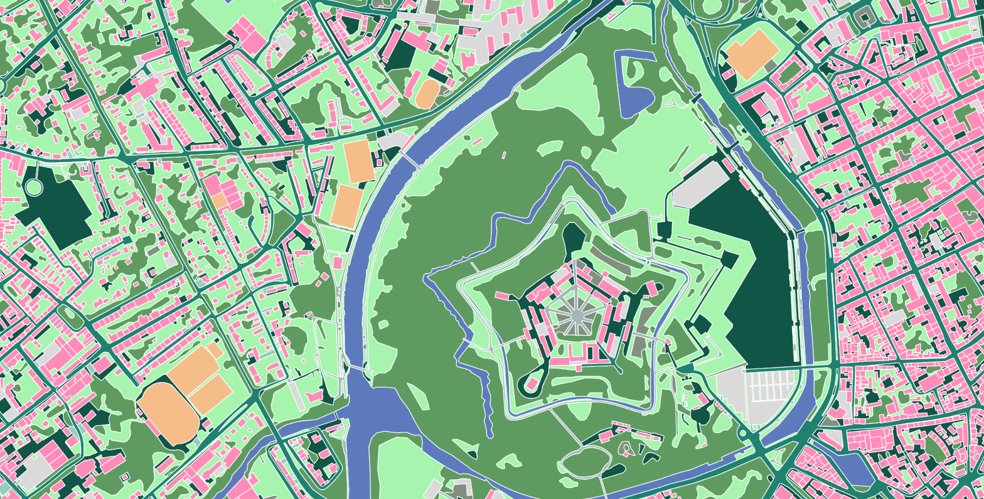
3D Land Cover
Foundational 3D & 2D land cover and land use vector map data for geospatial visualization, analytics, and decision-making.
-
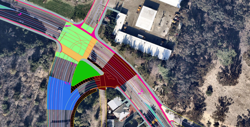
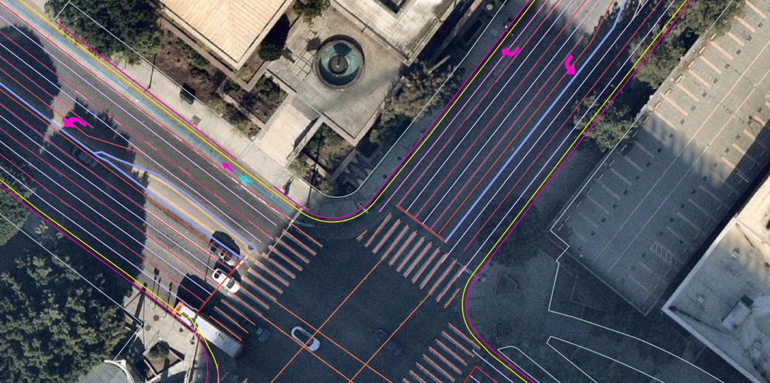
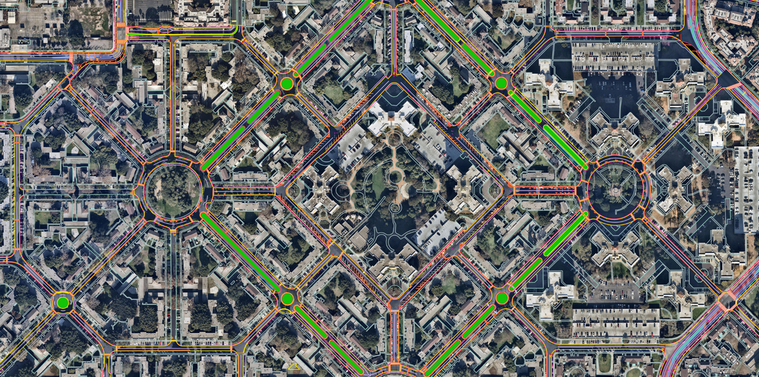
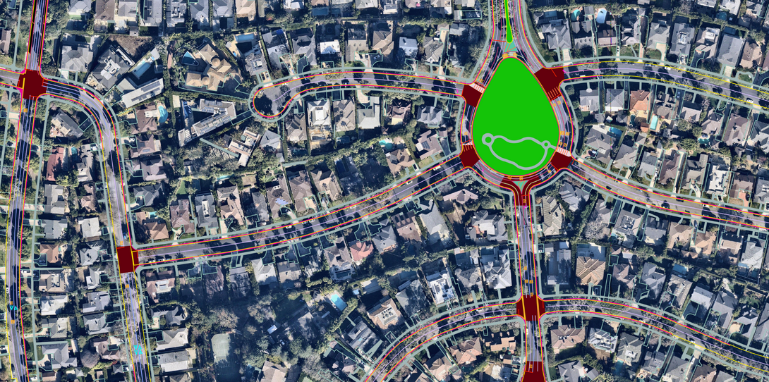
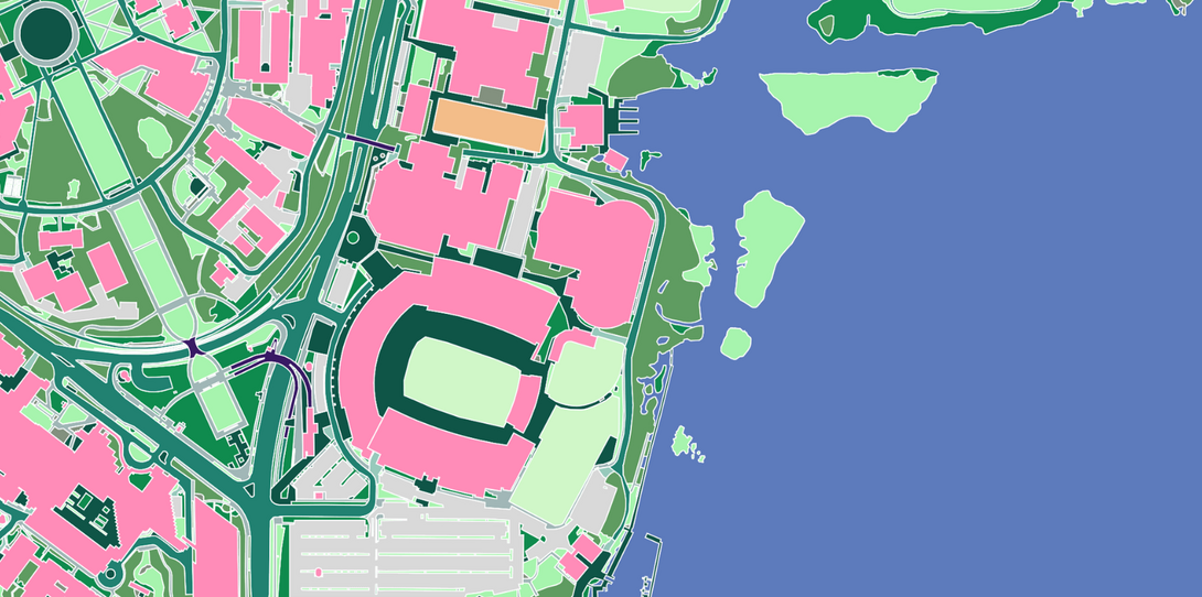
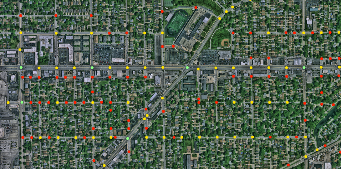
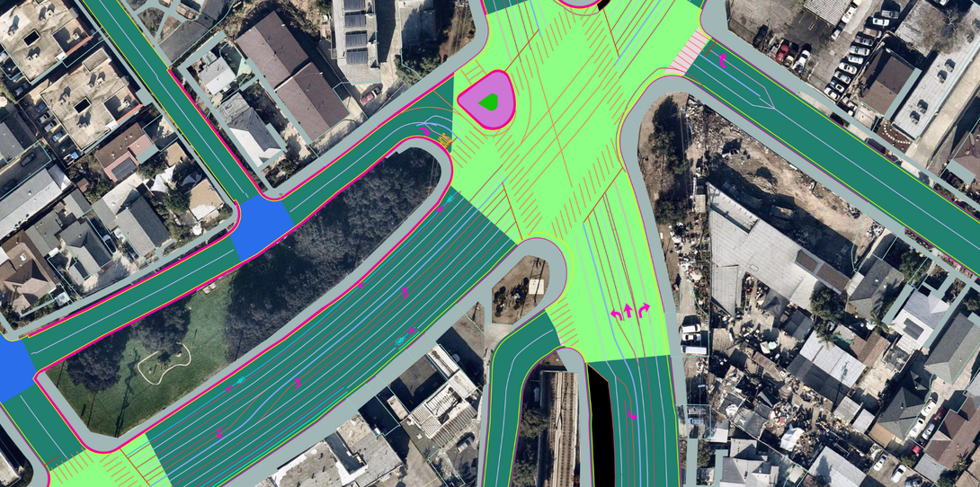
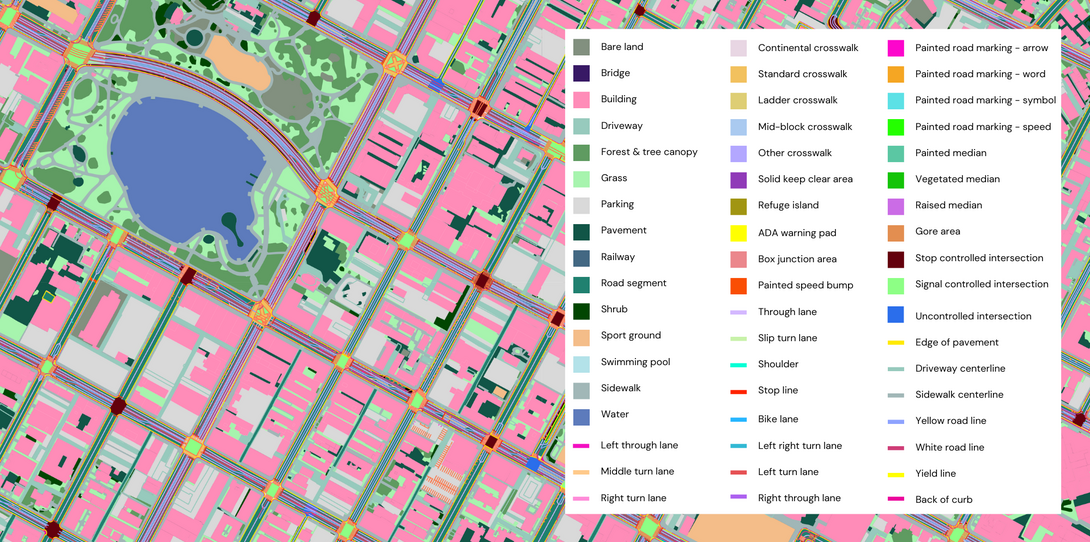
Advanced Transportation Features
Detailed transportation network data to power right-of-way analysis, active transportation plans, pedestrian safety improvements, permitting, and more.
-
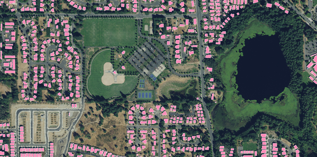
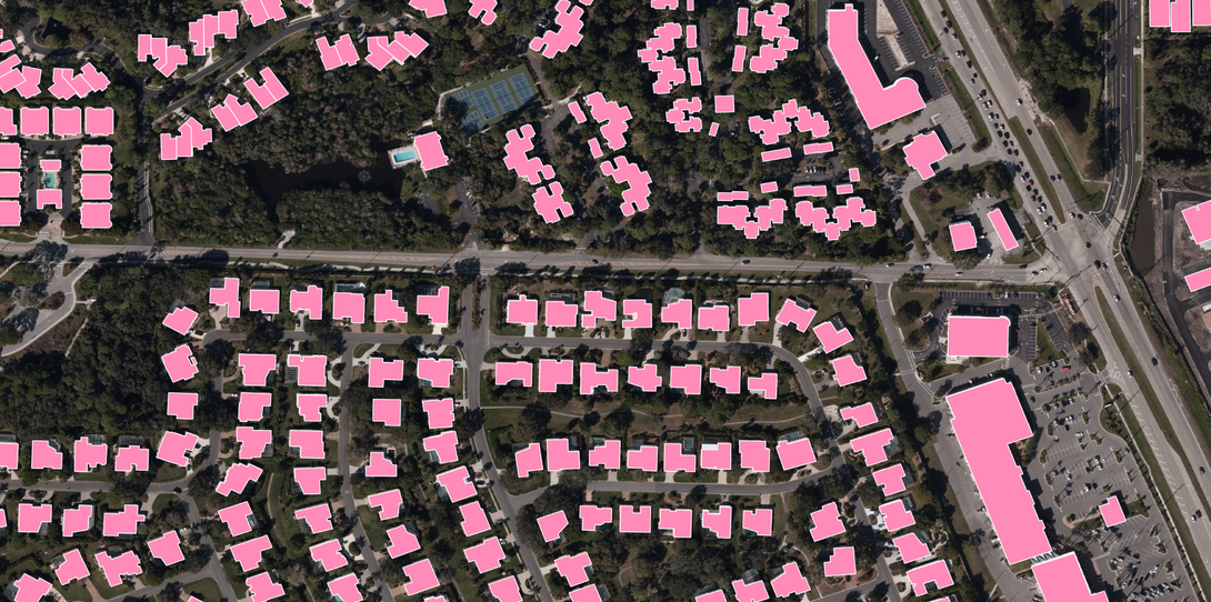
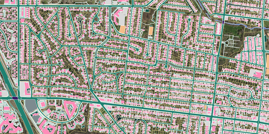
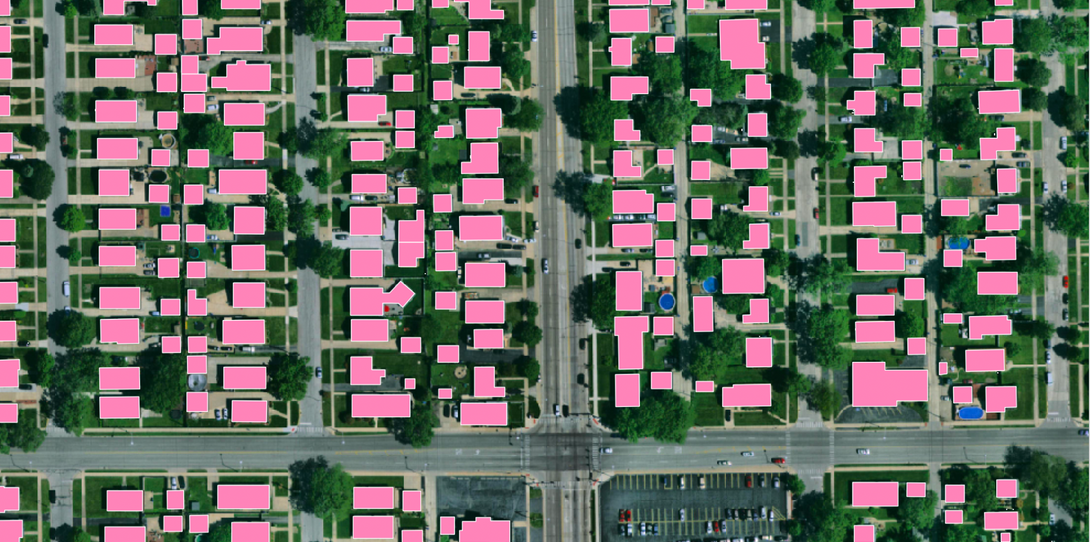
Building-Based Geocoding
178M+ high-precision building footprints and rooftop-level geocodes for more than 280 million primary and secondary US address points.
Ready to get started?
Get in touch with our team and explore our data portal.