
Smarter decisions start with better data
In 2025, the United States recorded 23 separate weather and climate disasters that each caused at least $1 billion in damage, totaling $115 billion in losses and marking the third-highest number of such events since 1980, according to Climate Central. As these events grow more frequent and costly, communities face increasing pressure to make faster, more informed decisions about infrastructure, land use, and environmental resilience.
Decisions like these depend on accurate, up-to-date geospatial data. Yet many governments are still relying on outdated, often incomplete data, built through slow, manual processes that cannot keep pace with a rapidly changing built and natural environment. That gap skews decision-making away from reality. AI-powered 3D Land Cover data from Ecopia® AI (Ecopia) how organizations plan, build, and respond to change.
The challenge: outdated data slows down critical decisions
Traditional geospatial data creation relies heavily on manual digitization, a process that is slow, expensive, and difficult to scale. At the same time, many newer automated tools promise instant, error-free results at the click of a button, but often introduce inaccuracies and inconsistencies that create more work down the line. For the organizations responsible for this data, this creates real consequences:
- Infrastructure data becomes outdated within months of collection
- Climate risk models are built on incomplete or inconsistent information
- Planning decisions are made with limited visibility into current conditions
In fast-growing or climate-vulnerable regions, these gaps translate directly into costlier inefficiencies and greater risk. Governments need data that is not only accurate, but scalable, consistent, and continuously updated.
The solution: Ecopia’s AI-powered 3D Land Cover data at global scale
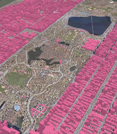
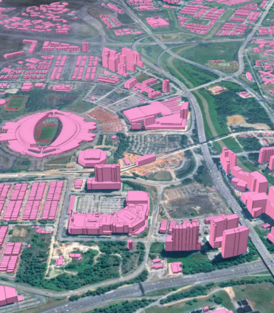
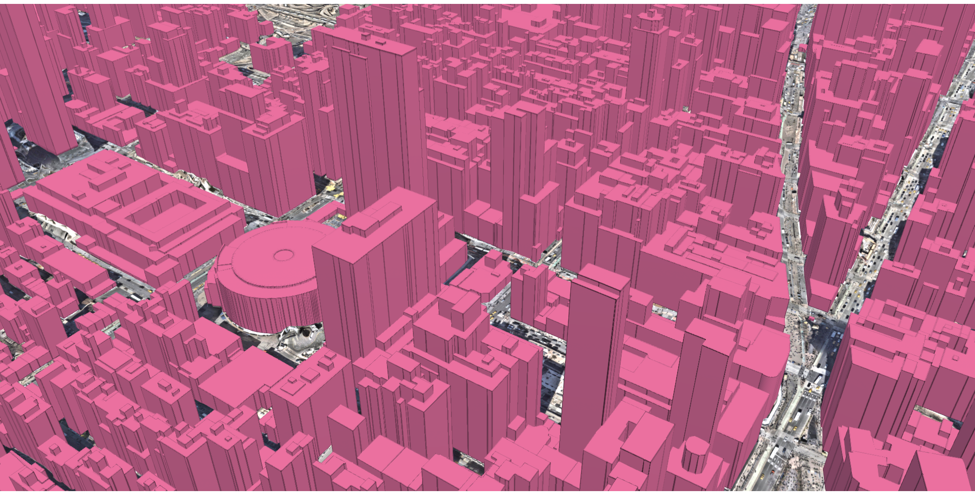
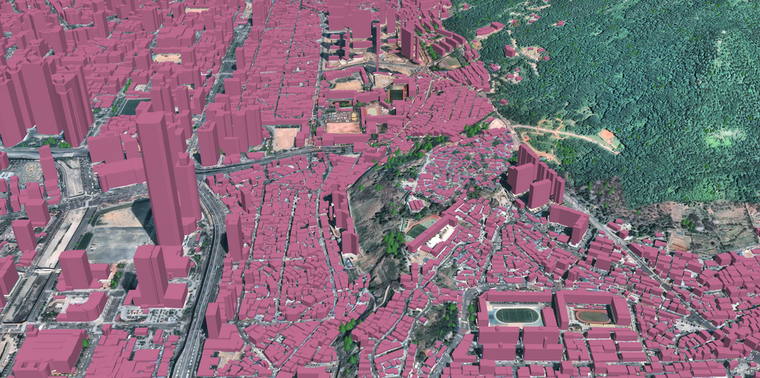
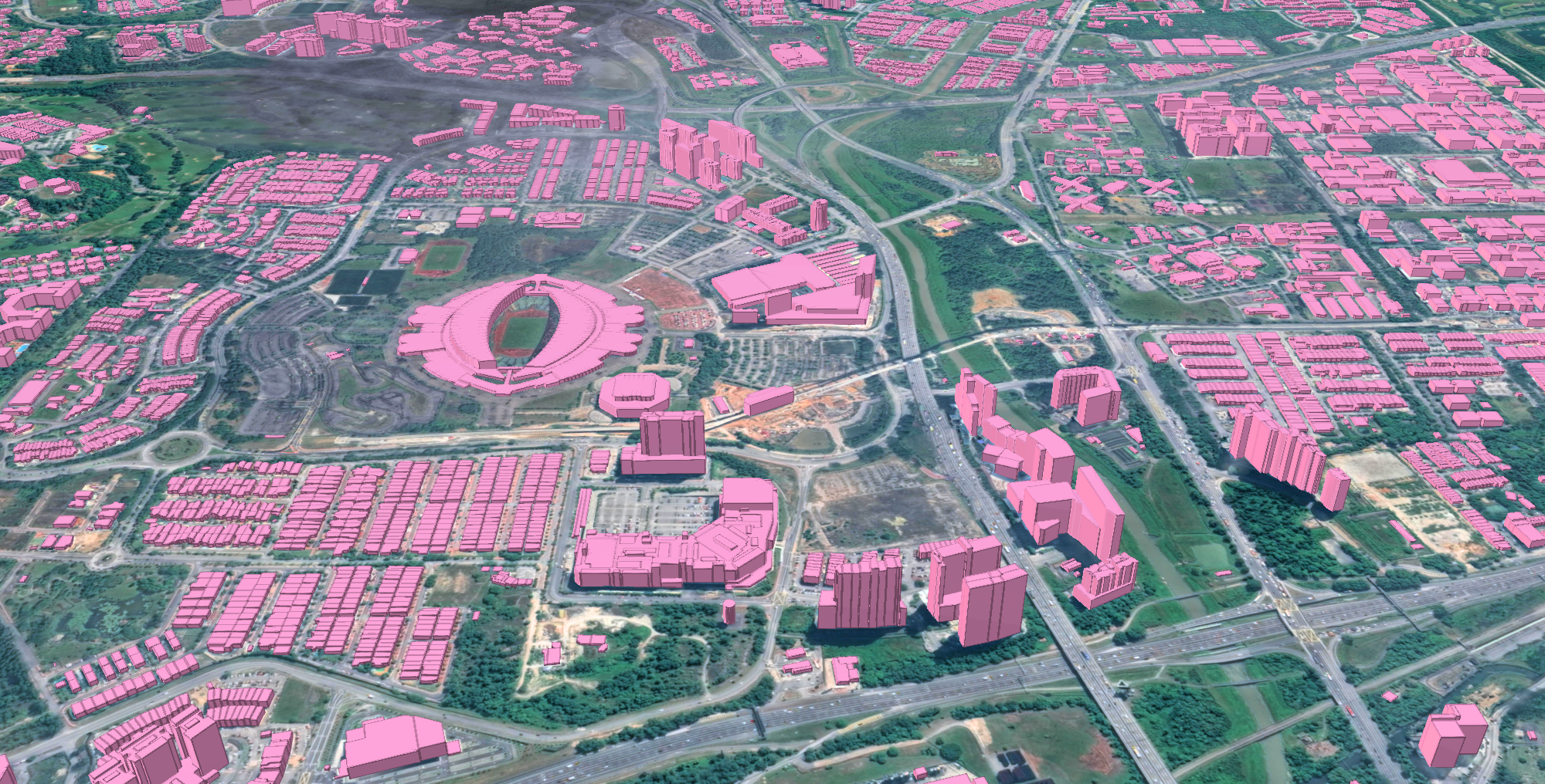
Ecopia uses artificial intelligence (AI) to extract high-precision land cover data from high-resolution imagery, generating 3D vector datasets that act as a digital twin of the built and natural environment. Ecopia’s AI-based systems extract features with over 95 percent geometric accuracy, matching or exceeding the quality of manual methods, at a fraction of the time and cost.
What sets Ecopia apart:
- High Precision at Scale. Feature extraction that matches or exceeds manual digitization accuracy, without the manual timeline.
- Global Coverage and Consistency. Standardized datasets produced across entire regions, ensuring consistency across municipalities and jurisdictions.
- Rapid Turnaround. What traditionally takes months or years can be completed in weeks.
- Continuously Updated Data. Fresh imagery sourced every year enables regular updates and change detection, so organizations are never planning around stale information.

Turning imagery into actionable insight
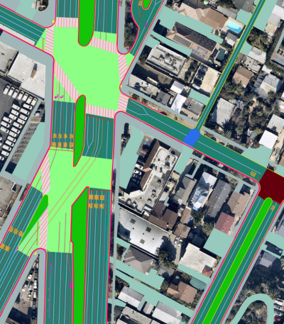
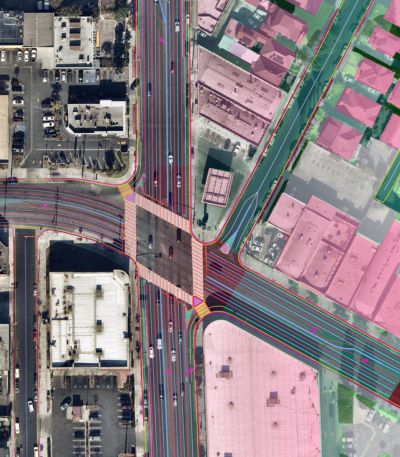
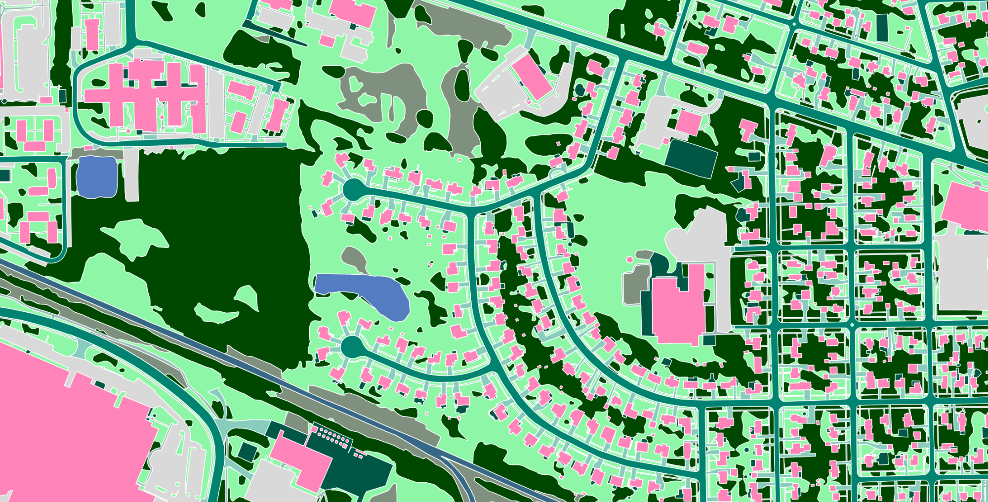
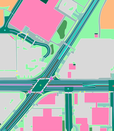
Ecopia’s 3D Land Cover data provides a structured, comprehensive view of the physical world, including buildings and structures, road networks, vegetation and tree canopy, water bodies, and impervious surfaces. Each feature is enriched with height attribution where applicable, integrating directly into existing geographic information system (GIS) workflows so it is immediately usable for planning and operational decisions.
The result: smarter planning and stronger climate mitigation
Urban planning and infrastructure development
With a complete and current view of the built environment, planners can identify infrastructure gaps, optimize land use, and support zoning decisions with confidence. The Southeast Michigan Council of Governments (SEMCOG) partnered with Ecopia to deliver high-precision land cover data across seven counties, giving regional planners a consistent foundation for infrastructure and land use decisions across jurisdictions.

Climate resilience and stormwater management
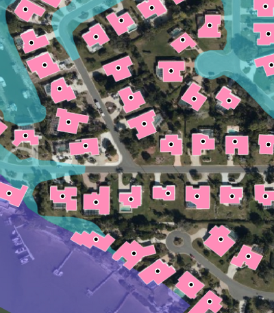
Accurate land cover data is essential to modeling flood risk, identifying impervious surfaces that contribute to runoff, and planning green infrastructure. Over 1,800 US municipalities now rely on impervious surface data to calculate stormwater utility fees, and the City of Jacksonville used Ecopia to map all natural and impervious surfaces across 363,272 parcels in just over four weeks, at an 84 percent cost savings. In Ontario, the City of Peterborough turned to Ecopia to strengthen its flood modeling with a comprehensive land cover dataset detailing the proximity of land features to watercourses.
Climate resilience extends to wildfire risk as well. The California Department of Forestry and Fire Protection (CAL FIRE) selected Ecopia to map building footprints and land cover across the state’s Fire Hazard Severity Zones. Nearly half of all buildings in California, over 8 million of the state’s 16.2 million total, sit within these zones, which span more than 30 percent of the state’s land and 32 million acres. Ecopia attributed each building footprint with distance to the nearest tree, water body, and neighboring structure, factors that directly inform wildfire mitigation and post-fire damage assessment.
Public safety and emergency response
Detailed 3D mapping improves how agencies prepare for and respond to emergencies. Ecopia partnered with NextNav to give Public Safety Answering Points (PSAPs) the ability to visualize z-axis coordinates on 3D building data, helping first responders identify which floor of a multistory building an emergency call is coming from. In Texas, Ecopia partnered with the Center for Water and Environment at the University of Texas and the Texas Department of Transportation to extract elevation data across more than 38,000 miles of roads and bridges, helping the state identify which routes remain safe for emergency vehicles during flood events.
What is next for smarter, more resilient communities
Municipal and state governments are at the forefront of addressing some of today’s most pressing challenges, from urban growth to a changing climate. Meeting these demands requires data that is accurate, scalable, timely, and actionable.
As imagery resolution improves and AI extraction methods continue to advance, governments can expect faster updates, deeper feature attribution, and broader integration with digital twin platforms such as NVIDIA Earth-2. For planning organizations, state agencies, and public works departments navigating fast-changing environments, Ecopia’s AI-powered 3D Land Cover data offers a path toward smarter planning, stronger infrastructure, and more resilient communities.
Get in touch with the Ecopia team to learn how AI-powered geospatial data can support your organization’s planning and resilience goals.
Learn more about Ecopia's solutions
Ready to get started?
