
Building 3D Site Context On Demand With Ecopia and PlaceMaker
Discover how PlaceMaker uses Ecopia's off-the-shelf 3D Land Cover data to bring accurate 3D site context into the modeling software design teams already use, in days rather than weeks.
Every site design project has a common starting point: a base map. Before an architect can test a massing study, before a landscape architect can site a park, before a civil engineer can lay out a corridor, someone has to build an accurate representation of what is already there: buildings, driveways, sidewalks, parking lots, tree canopy, water, and the boundaries between them.
Historically, that step has been the most time-consuming part of the project. Designers stitch together low-resolution aerials, collect street-level snapshots, trace features by hand, and wait weeks for a survey that may still arrive incomplete. The process is manual, repetitive, and must be complete before the design work even begins.
PlaceMaker was built to remove that step. With the integration of off-the-shelf 3D Land Cover data from Ecopia AI (Ecopia), PlaceMaker users have the ability to bring high-resolution site context directly into the tools they use on a daily basis: SketchUp, Revit, Rhino, Blender, and any other application that can import GLB and GeoJSON formats, in a matter of days rather than weeks.

The base map problem in 3D site design
PlaceMaker’s core user base sits squarely in the AEC world with architects, landscape architects, urban planners, and civil engineers who work primarily in SketchUp and Revit, alongside a growing set of users in solar studies, video game design, and environmental planning.
These users share a common limitation. The design applications they work in were never built to consume geospatial data. SketchUp and Revit cannot import shapefiles or GeoJSON directly, which means that even when high-quality vector data does exist, there is no straightforward path to get it into a software modeling platform. When SketchUp’s native Google Earth integration was retired, this gap widened considerably.
In the past, the alternative has been manual assembly, which is expensive in exactly the way that is hardest to bill for.
“I spent years doing this manually, putting everything together through Photoshop, copy and paste, collecting aerials and street views, stitching everything together and creating it from scratch. A simple base map could take half a day. Now, it takes five minutes.” - Daniel Tal, Co-Founder, PlaceMaker
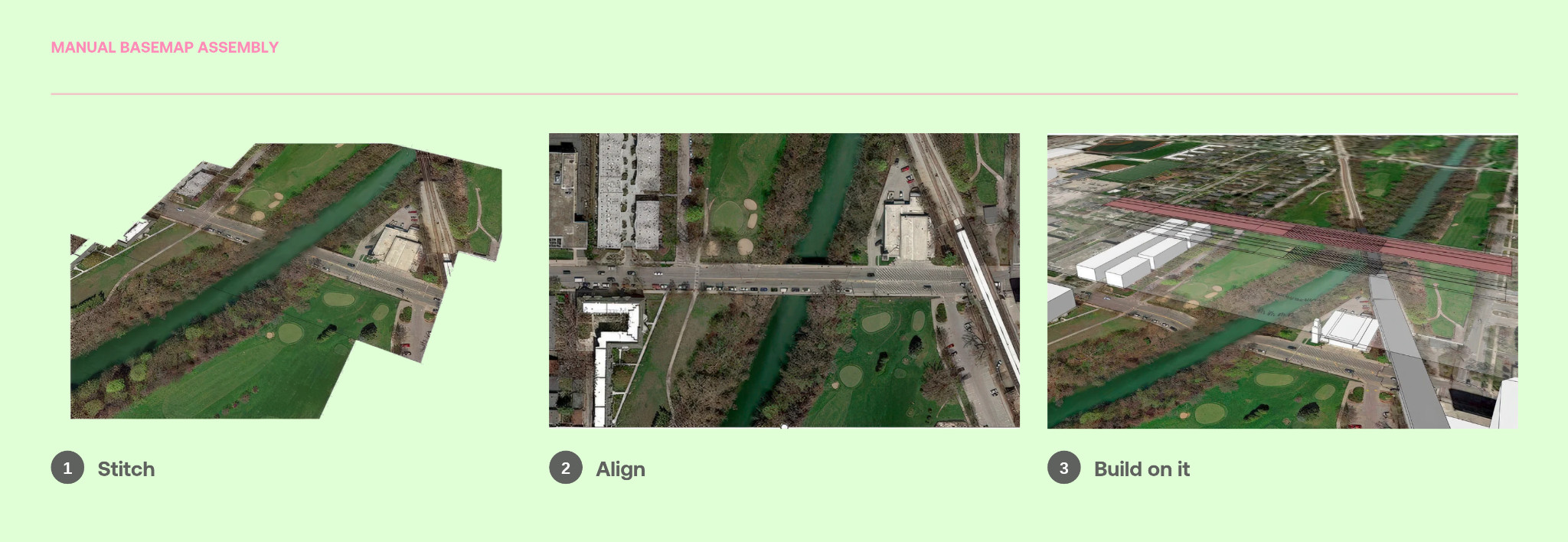
Traditional surveys add a second limitation. They remain essential for design and construction, but are slow, costly, and commissioned per project, which makes them a poor fit for early phases of work when teams are scoping, exploring options, and building project narratives before any commitment is made.
How Ecopia data fits into the PlaceMaker platform
PlaceMaker pulls a wide range of geospatial data into a single interface: aerial imagery from Nearmap, Hexagon, and Mapbox; Google and Nearmap terrain; OpenStreetMap datasets; 3D buildings; and point clouds. Ecopia’s data appears in that interface under a category called AI Land Cover.
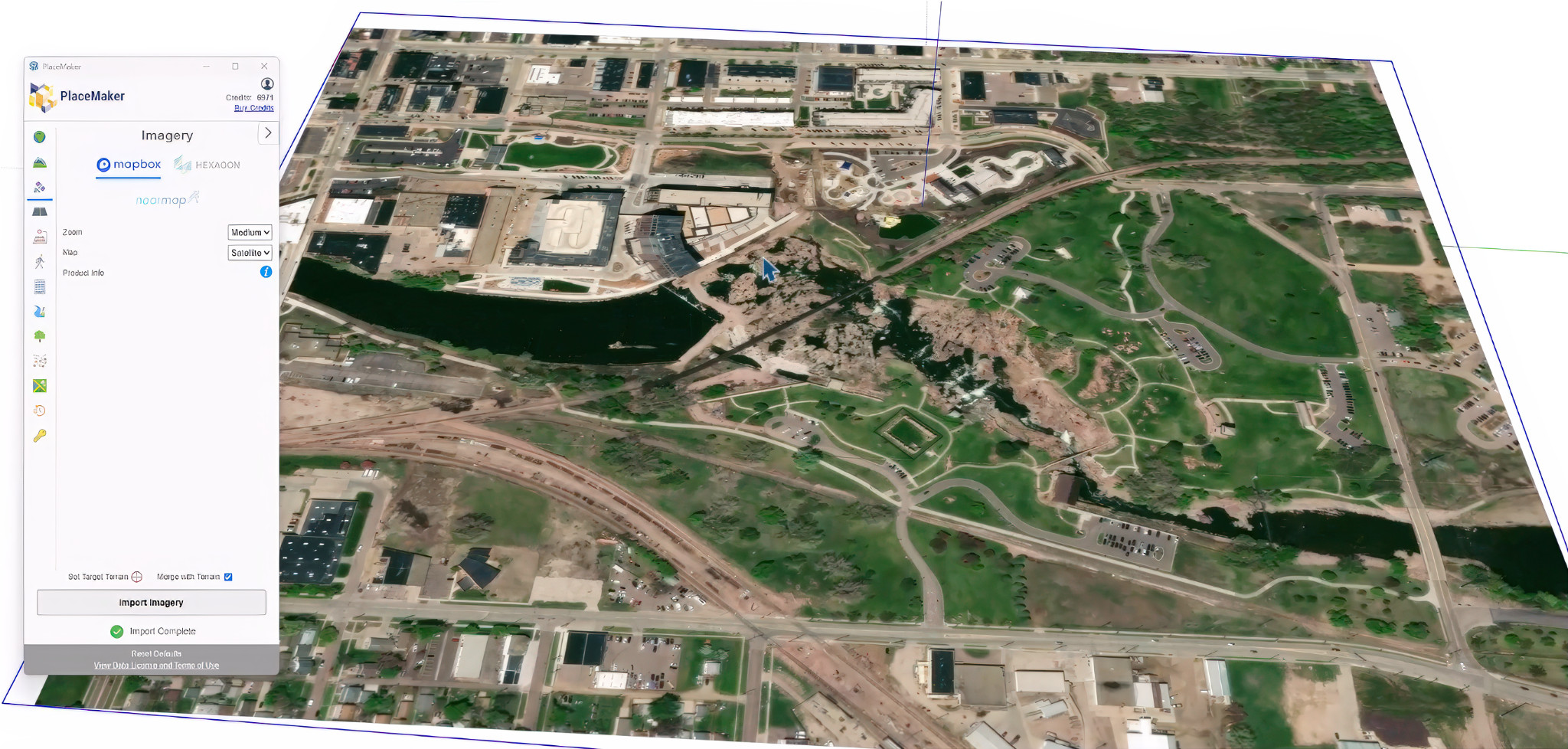
The workflow to retrieve Ecopia data through the PlaceMaker platform is designed to be as close to on-demand as possible:
- Users navigate to any location worldwide and drag a polygon over a region of interest.
- PlaceMaker displays the expected delivery window for that specific area.
- On confirmation, the order is fulfilled through Ecopia’s data portal and returned to users on the PlaceMaker platform.
- Once the order is complete, one click generates the dataset in SketchUp, Revit, or other desired host, as 3D plans.
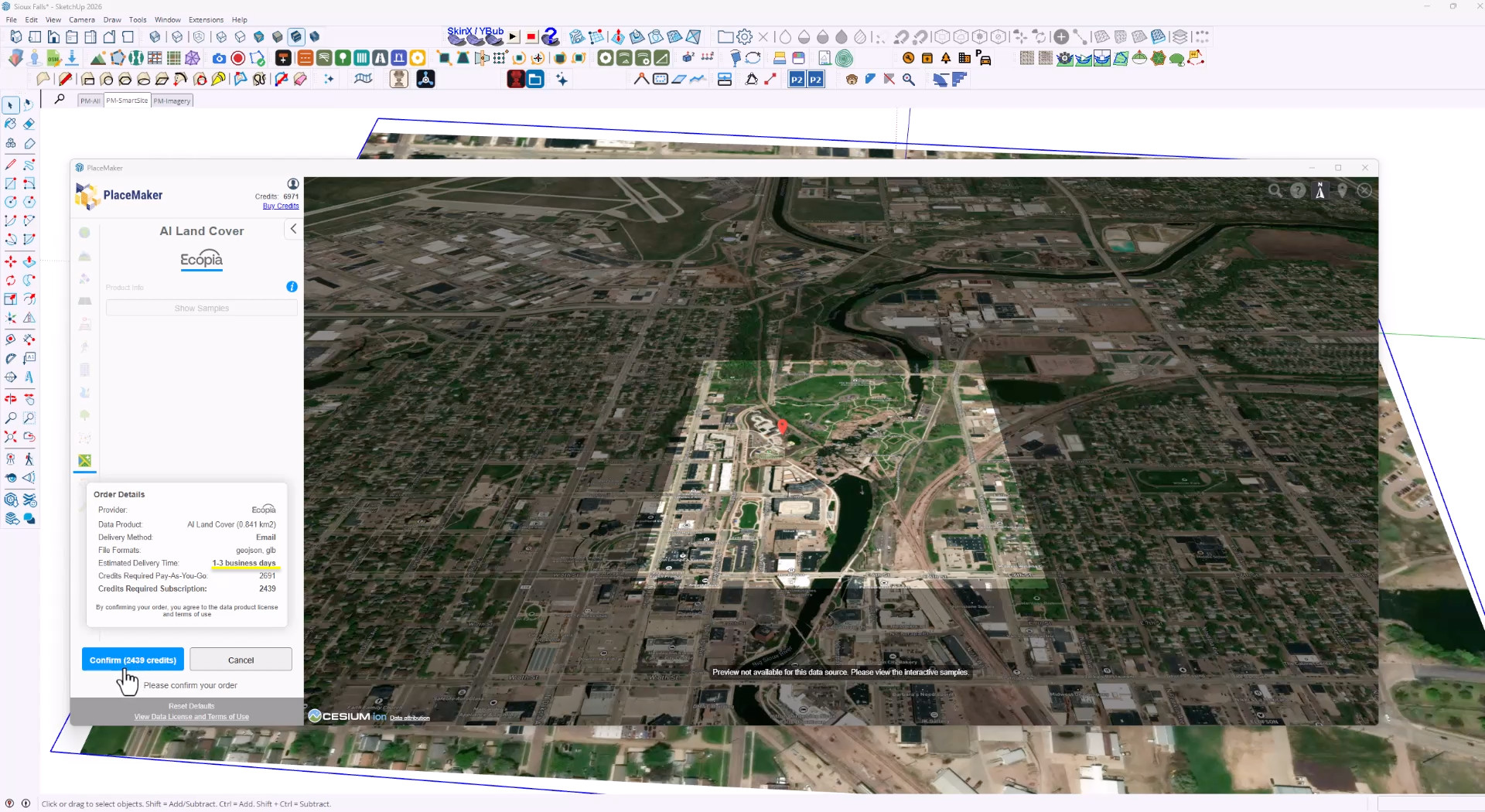
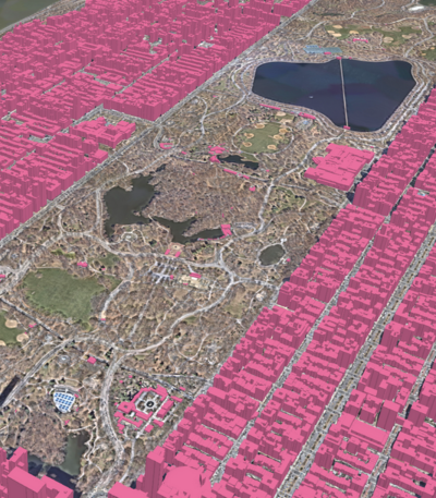
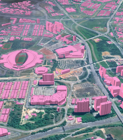
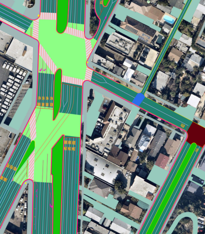
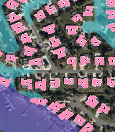
Crucially, the classification structure of the data survives the trip. Every layer that Ecopia delivers is preserved as a distinct tag in SketchUp or layer in Revit: buildings, roads, driveways, sidewalks, parking lots, water, tree canopy, and more. Users can toggle features on and off, isolate what matters most to their project, and ultimately export clean, layered files.
[slider]
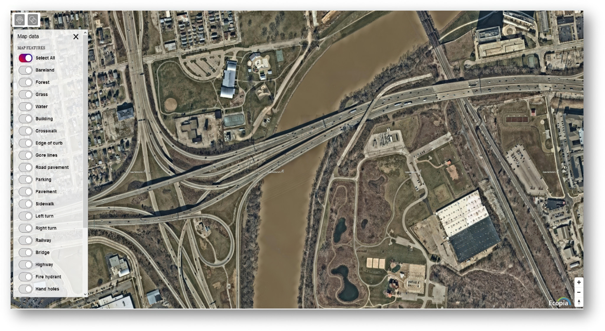
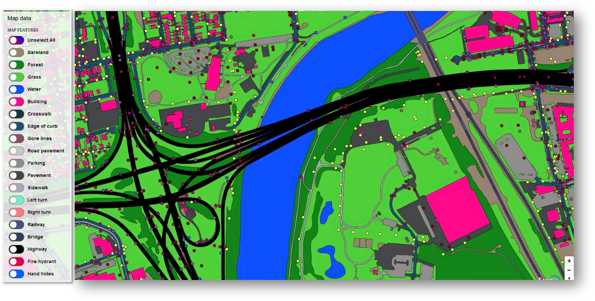
Ecopia’s vector layers accurately line up with the imagery underneath. This gives PlaceMaker the confidence in knowing that their end-users are receiving quality basemaps.
Because Ecopia’s 3D Land Cover is readily available off-the-shelf rather than commissioned project by project, PlaceMaker is able to quote a 1-3 day delivery window to its users. That represents a substantial change from how the two companies worked together previously.
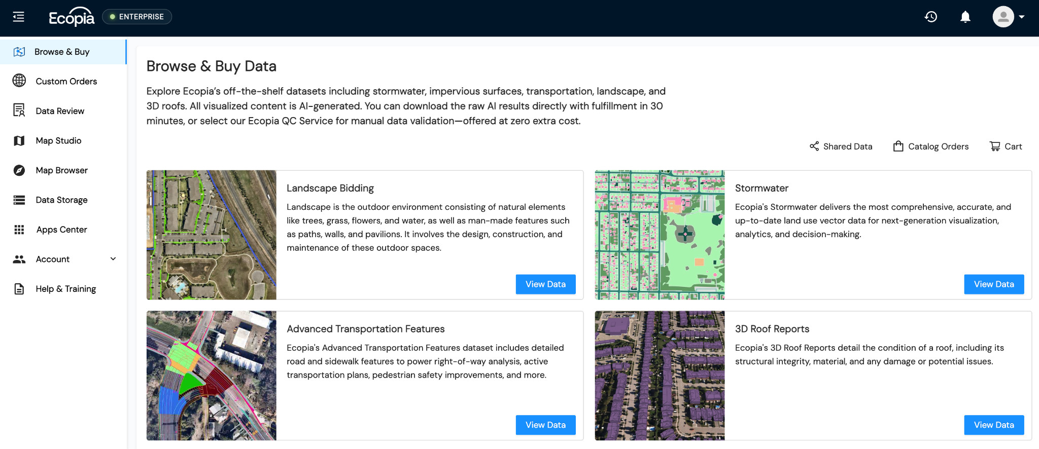
“The biggest problem over the years was that the turnaround time was 4-6 weeks, or more, to get an order back. With Ecopia’s new platform, we can now get datasets back within a day, sometimes a little more. That’s really huge because PlaceMaker is an on-demand data platform. The more on-demand we can get the data, the better.” - Dale Martens, Co-Founder, PlaceMaker
Why accuracy is the deciding factor
PlaceMaker offers its users a choice of data sources, and the reason Ecopia’s 3D Land Cover occupies its own category comes down to precision. With that precision comes the ability to answer questions an architect or engineer asks at the site scale: where exactly does this driveway meet the street? What is the true footprint of this building? What surface area of this park is covered by tree canopy?
Ecopia’s artificial intelligence (AI) mapping technologies extract vector features from high-resolution aerial and satellite imagery at greater than 95% geometric accuracy, with 75+ planimetric layers available off-the-shelf across 400 US cities. That level of accuracy is what makes the data usable as reliable base plans rather than a reference image.
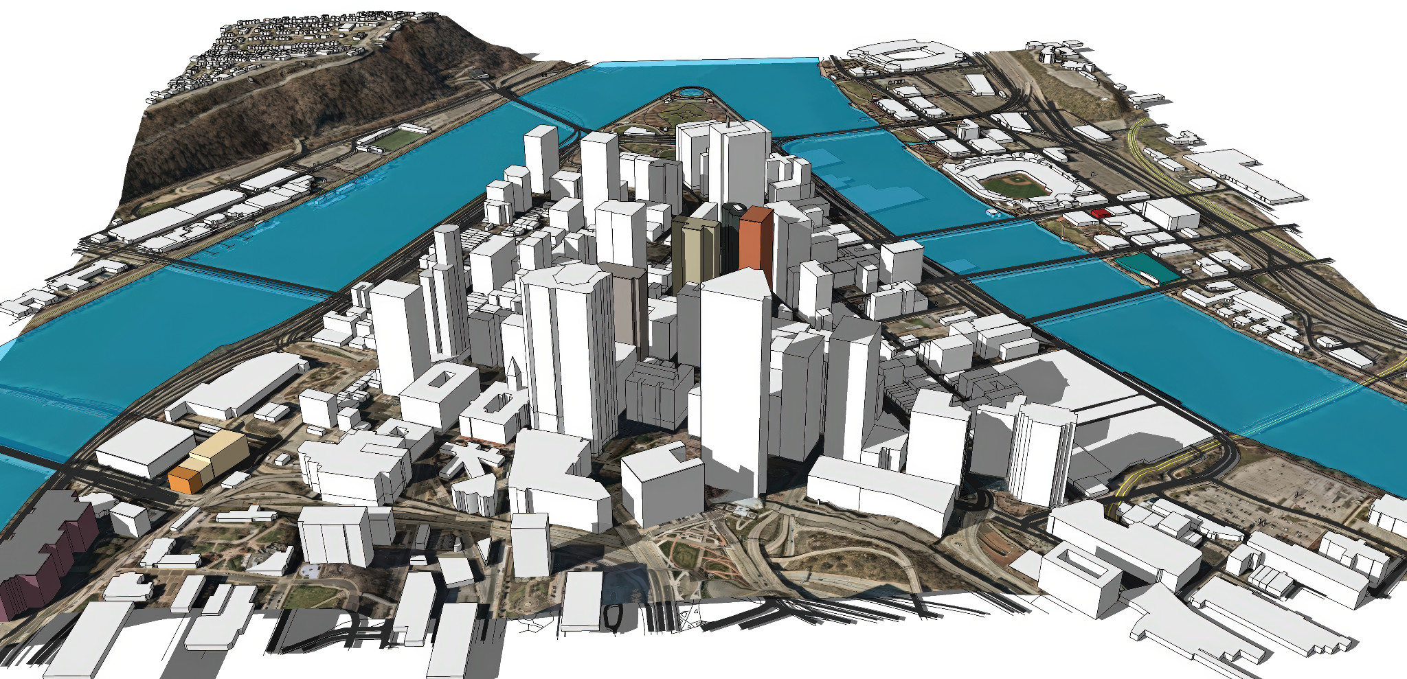
“There’s a level of accuracy the general datasets simply don’t have. Ecopia is accurate, scary accurate. That’s what designers need for projects: pre-project, during project, post-project.” - Daniel Tal, Co-Founder, PlaceMaker
Ecopia’s 3D Land Cover is not a replacement for survey data, and it is not certified as such. What it does do is get design teams most of the way there, quickly, and at a scale that boots-on-the-ground surveys could not match efficiently or economically. For firms exploring projects, evaluating sites, or building early design plans, that distinction is the entire value proposition.
What comes next
PlaceMaker’s Version 4 officially launched in June 2026, and introduced browser-based access alongside SketchUp and Revit extensions, meaning users can order and manage data without opening a modeling application at all.
Early adoption of the AI Land Cover category has followed a familiar pattern, where large architecture firms are ordering small areas to evaluate quality before committing to larger project footprints. Both PlaceMaker and Ecopia continue to work towards a further automated pipeline between the two platforms, which would decrease delivery times even more, and uphold the on-demand value of Ecopia’s and PlaceMaker’s data.
For the visualization groups inside the world’s largest design firms, the people responsible for producing base maps and site context for everyone else, PlaceMaker provides a single point of access. Ecopia provides the accuracy and rapid delivery.
Learn more
To explore Ecopia’s off-the-shelf 3D Land Cover data, register for Ecopia’s data portal where you can browse coverage and download free samples. To see how PlaceMaker brings that data directly into your 3D modeling environment, visit placemakerdata.com.
–
About Ecopia AI
Ecopia is on a mission to create a digital twin of the Earth. We leverage artificial intelligence to convert high-resolution imagery into high-precision 3D vector map data at scale. This data creates a digital representation of the physical world, forming the foundation of a digital twin for visualization, analytics, and decision-making. Ecopia’s data is leveraged by hundreds of commercial and government organizations across more than 100 countries around the world.
About PlaceMaker
PlaceMaker is a geospatial 3D data platform catered to site, urban, and architectural design. It gives SketchUp, Revit and other design software users on-demand access to aerial imagery, terrain, 3D buildings, point clouds, and AI-derived land cover from a single interface, allowing project teams to build accurate 3D site context in minutes.
Ready to get started?
