
Scaling Sidewalk Gap Analysis with AI Map Feature Extraction
See how Renaissance Planning Group uses Ecopia sidewalk data to identify and prioritize 1,800 miles of pedestrian gaps across a two-state metropolitan region.
Prioritizing investments to improve pedestrian infrastructure
For a metropolitan planning organization (MPO), knowing where pedestrian infrastructure exists is only the first step for making improvements. The more pressing question, and the harder one to answer, is where it is missing and where those gaps matter most.
The Wilmington Area Planning Council (WILMAPCO) serves New Castle County, including the City of Wilmington in Delaware, and Cecil County, Maryland, and is responsible for transportation planning across a 744 square mile, geographically diverse region that’s home to just over 625,000 people. The region ranges from dense urban neighborhoods in Wilmington to rural stretches of Cecil County, and spans two states, two departments of transportation, and dozens of municipalities, each with its own data practices, coverage standards, and investment histories.
Recognizing the unique challenges posed by a planning area that spans two states with differing regulations, demographics, and infrastructure conditions, WILMAPCO selected Renaissance Planning Group to develop a comprehensive approach to improving walkability and reducing pedestrian risk. The engagement drew on Renaissance's expertise in multimodal transportation planning, allowing the team to conduct thorough assessments of existing pedestrian infrastructure, identify high-risk corridors and intersections, and develop prioritized, data-driven recommendations tailored to the region's varied urban, suburban, and rural contexts.
However, before deciding where to invest, both WILMAPCO and Renaissance Planning Group needed to know where sidewalks were absent altogether. That required a consistent, comprehensive, and current inventory of sidewalk infrastructure across all jurisdictions, something that had taken months to develop manually in the past, making it too costly to easily maintain. Without a current foundation, a reliable gap analysis was not possible.
The challenge: creating a unified baseline across a fragmented multi-jurisdictional region
WILMAPCO had conducted a pedestrian prioritization study roughly a decade before engaging Renaissance Planning Group, but that effort did not identify actual network gaps and relied on data that was siloed by jurisdiction and source. Available datasets covered different geographies, used different schemas, and had been captured at different points in time. For example, some focused only on state highways, and others only on specific municipalities. Stitching them together would have produced an unreliable patchwork, not an authoritative regional inventory that could be used to prioritize investment.
The scale of the problem was also significant. Simply closing every sidewalk gap in the region would ultimately cost over $1B, an amount no single funding cycle could address. Without a way to score and rank gaps based on where they matter most, that staggering total would render any analysis effectively unusable. Decision-makers needed a tool to focus limited resources on the small fraction of gaps with the greatest impact.
Manual digitization of current imagery, the traditional method of creating up-to-date map data, was considered and quickly ruled out. The effort required to trace sidewalks from imagery by hand across the full region would have consumed WILMAPCO’s entire project budget before the analysis even began, leaving no resources for prioritization, stakeholder engagement, or actionable recommendations.
“We knew going in that the existing data wasn't going to get us where we needed to be,” said Heather Dunigan from WILMAPCO. “Every jurisdiction had something different, and none of it was compatible. We needed a clean slate: a single, consistent picture of the entire region."

What the project needed was a way to acquire a high-quality, consistent sidewalk inventory across the entire region efficiently, affordably, and at a level of accuracy that could be used to justify public investment.
The solution: AI feature extraction
Through previous collaboration with aerial imagery provider Nearmap, a partner of Ecopia, Renaissance Planning Group was familiar with how Ecopia's AI map engine seamlessly transformed high-resolution imagery into precise, analysis-ready geospatial data. This existing knowledge and confidence in Ecopia's technology made it a natural choice when Renaissance sought powerful, accurate data extraction solutions for pedestrian safety and accessibility planning efforts.
Before committing to Ecopia, the team conducted a broader review of AI and machine learning-based geospatial data providers to evaluate the market. Ecopia emerged as a clear leader in the quality and reliability of its extracted transportation features. Further, the combination of Nearmap's high-resolution imagery and Ecopia's AI map engine gave the team confidence that accuracy would hold up consistently across both the urban and rural portions of the region.
"What set Ecopia apart wasn't just the accuracy; it was the consistency,” said Joel Lehman, Senior Planner at Renaissance Planning Group. “When you're working across two states and dozens of jurisdictions, you can't have a solution that performs well in one place and falls apart in another. Ecopia held up everywhere.”
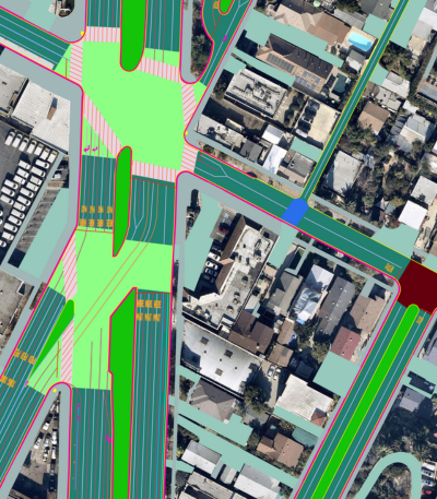
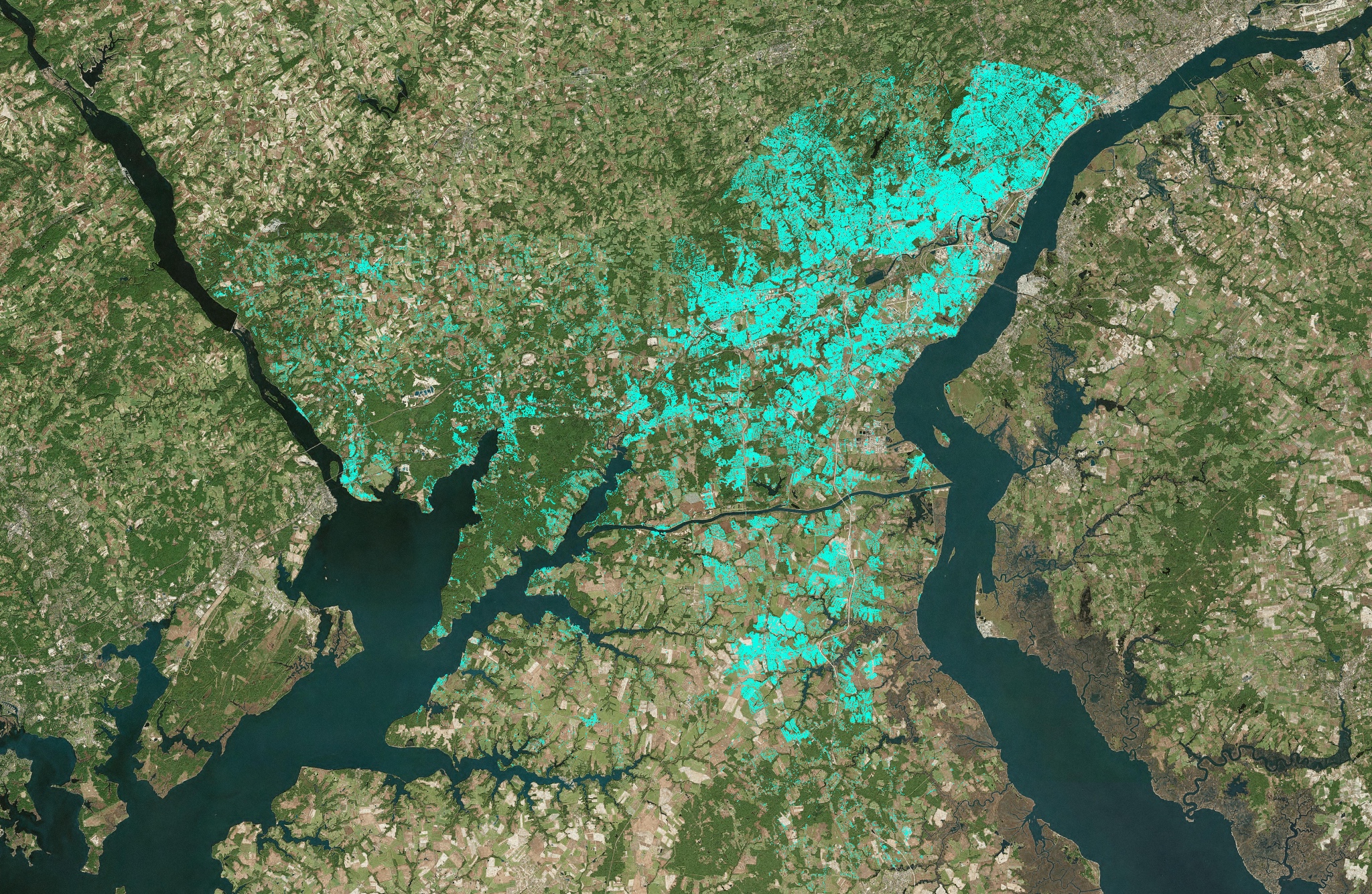
In a matter of weeks, Ecopia efficiently and cost-effectively extracted high-precision width-attributed sidewalk and crosswalk data from Nearmap imagery across WILMAPCO’s entire jurisdiction. The sidewalk layer became the foundational dataset for the entire project, with crosswalk centerlines queued up for future use in corridor studies. This data was combined with road centerlines from state DOT sources in Delaware and Maryland, both of which had recently completed bicycle level-of-traffic-stress databases.
"Ecopia enabled us to provide more value to the client while staying within their budget," added Lehman. "The alternative would have consumed the entire budget on data collection alone, leaving nothing for the analysis that actually matters."
The result: an unprecedented regional sidewalk gap inventory
With the Ecopia sidewalk data in hand, Renaissance developed a custom GIS methodology to detect where sidewalks were missing relative to the road network. The process overlaid Ecopia's sidewalk layer with DOT road centerlines, then cast rays at 90-degree angles every two feet from each centerline to estimate roadway width and detect sidewalk presence on each side of the road.
The output coded every road segment by coverage status: green for sidewalks present on both sides, orange for one side missing, and red for both sides absent. The algorithm also distinguished public right-of-way sidewalks from private walkways using angle calculations and proximity to buildings, and excluded intersections from the gap assessment to avoid overcounting. The result was approximately 1,800 miles of identified sidewalk gaps across the full region.
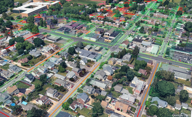
"Seeing the full regional picture for the first time was striking,” said Heather Dunigan from WILMAPCO. “We've always known there were gaps, but having 1,800 miles mapped and color-coded in a single, consistent dataset made the scale of the challenge impossible to ignore and gave us something we could act on."
However, identifying gaps is only useful if decision-makers can determine which ones to address first. The Renaissance Planning Group team next worked with WILMAPCO and a broad stakeholder network including counties, state DOTs, transit agencies, municipalities, school districts, and regional partners to develop a weighted prioritization framework built around four themes:
- Land use: proximity to key destinations and activity centers
- People: population and job density, economic opportunity zones, and areas with higher concentrations of residents who depend on walking due to lower income, limited vehicle access, or mobility challenges
- Transportation: connections to multiuse paths, pedestrian volumes, and proximity to transit stops
- Comfort: pedestrian-level traffic stress based on road speed, volume, and lane count adjacent to each gap
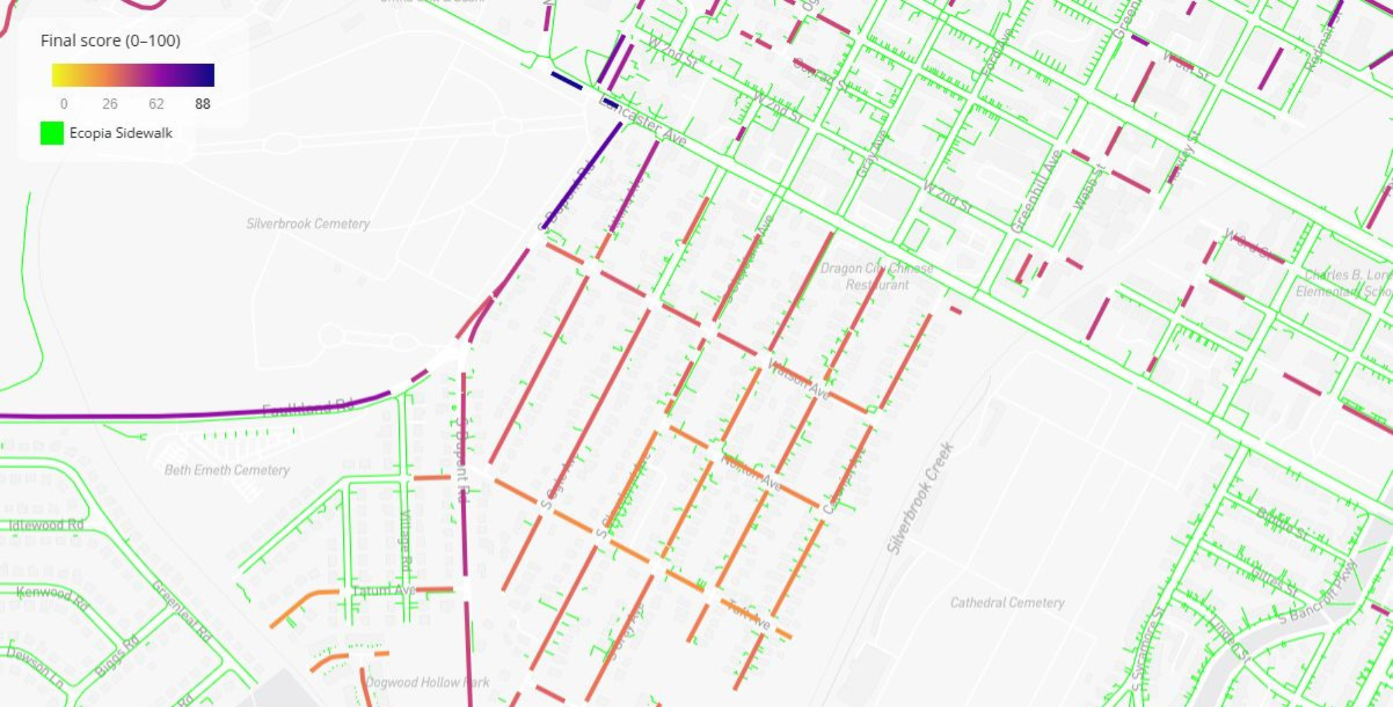
To enable stakeholders to participate in the weighting process, Renaissance Planning Group built a custom interactive web application containing the Ecopia data. Stakeholders were able to adjust the weight assigned to each theme and immediately see how those changes shifted gap priority scores on a live map, producing a transparent, intuitive way to reach consensus. After iterative surveying and feedback cycles, all four themes were ultimately weighted equally, reflecting the diverse and sometimes competing priorities of the region's stakeholders.
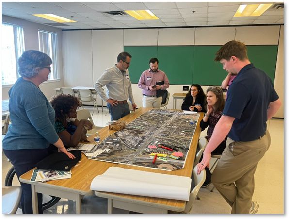
Building upon this feedback, a public-facing version of the web tool invited community members across the region to submit sidewalk gaps they knew about from personal experience. These submissions served as an independent quality check on the Ecopia data, with the vast majority of reported gaps already accurately captured in the dataset. Only a small number of submissions prompted manual corrections, a strong validation of Ecopia's accuracy at regional scale.
"We were genuinely impressed by how well the Ecopia data held up against what community members were telling us,” said Lehman. “When residents submit gaps and the data already has them, that's when you know you have a source of truth."
These efforts produced a ranked inventory of sidewalk gaps, a resource WILMAPCO and its member jurisdictions had never had before. Rather than confronting an undifferentiated list of 1,800 miles of missing infrastructure, planners can now focus on the small percentage of gaps with the highest priority scores: those in areas of greatest need, highest pedestrian activity, and most challenging traffic conditions.
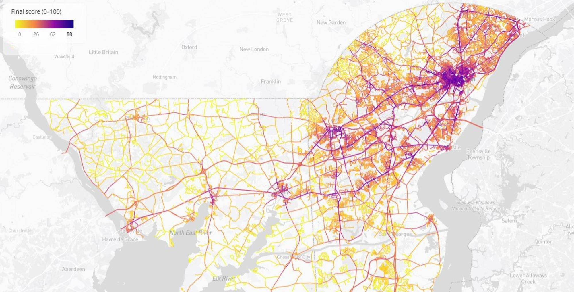
Jurisdictions across the region can use the priority scores directly to support grant applications, target capital investments, and demonstrate data-driven decision-making to funding agencies.
The public project report produced by Renaissance Planning Group and WILMAPCO can be found at wilmapco.org/sidewalk/.
What's next?
The infrastructure built for this project (both the data and the methodology) is designed for long-term use. The crosswalk centerlines acquired through this project will support upcoming corridor studies and more detailed active transportation planning. Future work is expected to incorporate intersections and crosswalk-level analysis, building on the foundation established here.
WILMAPCO intends to use this framework to monitor how the sidewalk network evolves over time, tracking progress, identifying newly emerging gaps, and measuring the impact of completed investments as new data becomes available.
Ultimately, this project gives WILMAPCO a repeatable, scalable framework for infrastructure prioritization, and one grounded in high-quality, AI-extracted geospatial data and built to serve the region's communities for years to come.
To learn more about Ecopia's transportation data solutions, get in touch with our team.
Ready to get started?
