Resources
Explore all of our content to learn more about how Ecopia is digitizing the world with AI.
News
Company Announcements
Ecopia AI Receives Innovation in Mapping Content Award at GeoBuiz Summit

Blog
Transportation Planning
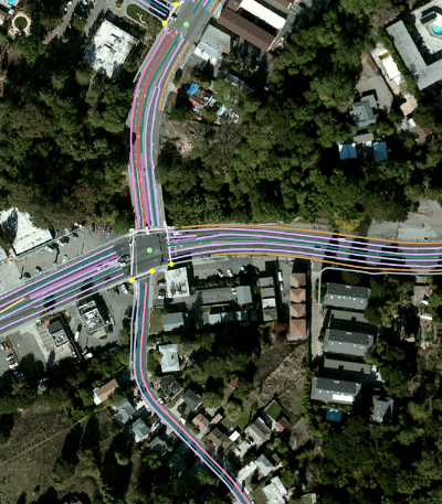
Ecopia's Pedestrian Right-of-Way Maps: Foundational Data for Safe & Accessible Communities
Case Study
Insurance
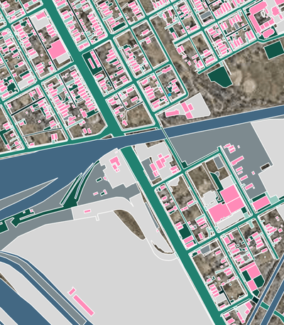
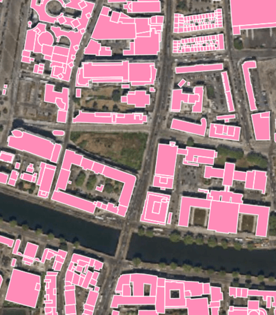
Leveraging Ecopia AI's Building-Based Geocoding to Enhance Replacement Cost and Risk Estimation

News
Digital Twin
Ecopia AI Partners with Snap Inc. Subsidiary to Pilot 3D Map Content Integration

News
Company Announcements
Ecopia AI Receives Technology Innovation Award at Geospatial World Forum

News
Partnerships
Ecopia AI and Airbus Expand Partnership to Enable Global 3D Vector Mapping

News
Transportation Planning
Ecopia AI to Support San Bernardino County Planning Initiatives Including Multi-Modal Transportation and Accessibility

Case Study
Climate Resilience
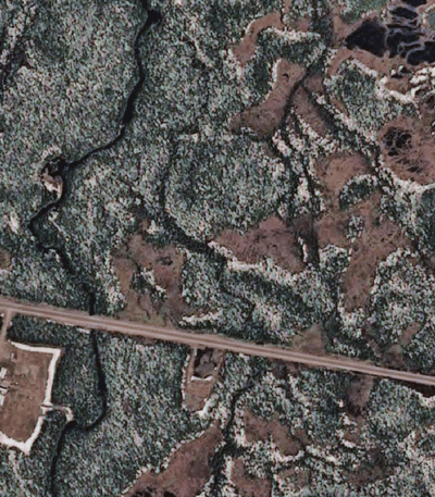
Extracting Impervious Surface Data to Support Stormwater Planning and Assessment
Blog
Partnerships
Digitizing the World with Ecopia's AI-Based Mapping System & Global Partner Network
News
Network Planning
Ecopia AI Awarded Contract from Canadian Government to Support Rural Broadband Mapping Across the Country
News
Climate Resilience
King County, WA to Leverage Ecopia’s High-Precision Land Cover Map For Sustainability and Public Infrastructure Decision-Making

Blog
Public Safety
Transforming Next-Generation 911 Systems with AI-Powered GIS Data