
Ecopia AI & Vantor: mapping the world at unprecedented scale
Ecopia AI (Ecopia) and Vantor’s partnership has been transforming the geospatial industry for over a decade. What began in 2015 as a collaboration to map every building across a single continent has evolved into one of the most ambitious mapping programs ever undertaken: a commitment to produce more than one billion features around the world, delivered with the accuracy, consistency, and currency that today’s geospatial workflows demand.
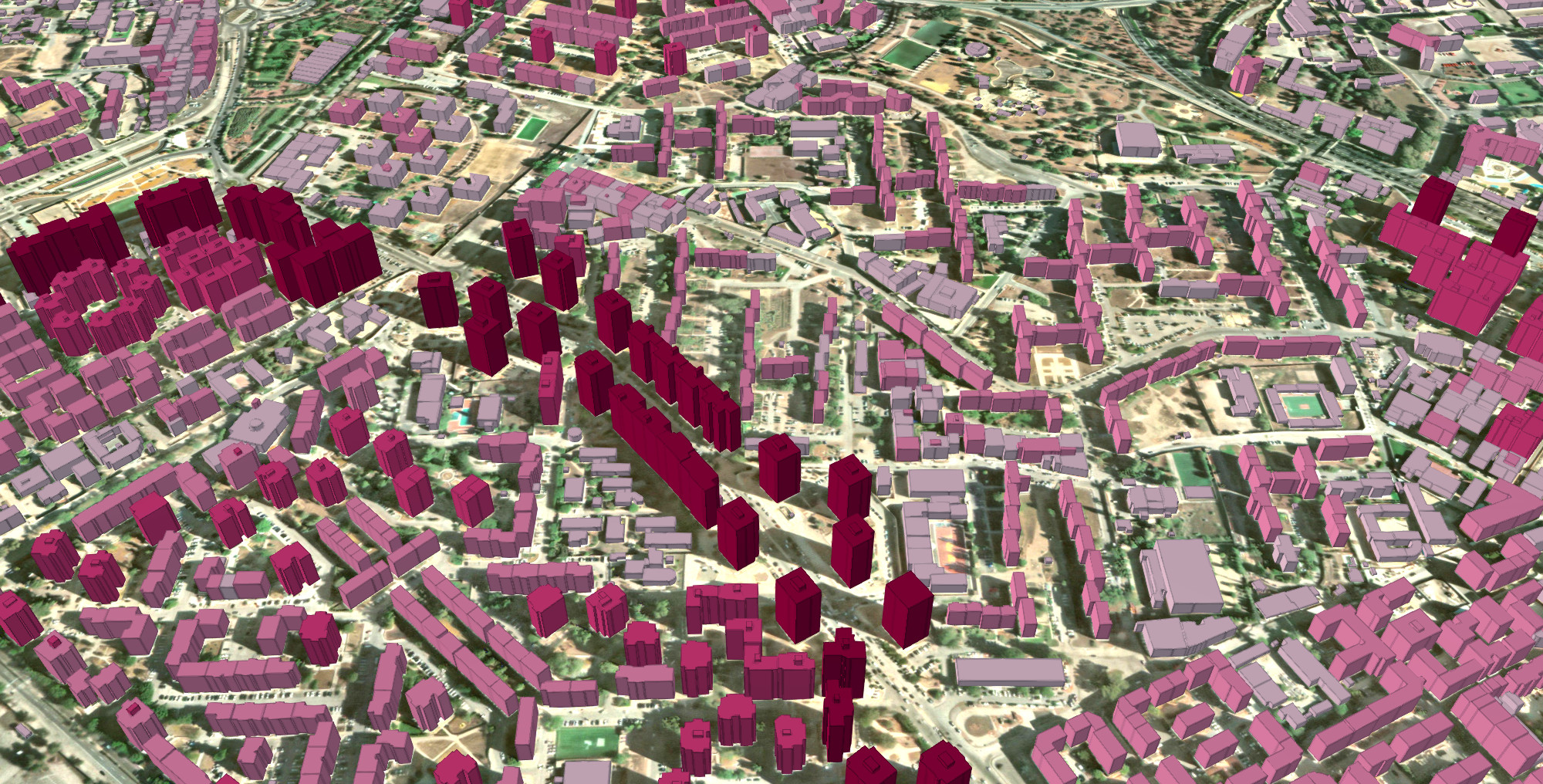
Vantor provides the trusted spatial foundation behind the partnership that combines high-resolution satellite imagery, 3D data, and automated spatial fusion technology to create an accurate, consistent view of the world, keeping data aligned across geography, sensors and time. Its satellites collect nearly 7 million square kilometers of spatially aligned high-resolution imagery every day and can revisit any location on Earth up to 15 times in a single day. This unmatched global coverage is backed by a 20+ year archive of high-resolution satellite imagery, including more than 30 cm-class imagery, and automated spatial fusion technology that maintains industry-leading accuracy of approximately 3 meters globally, providing Ecopia’s AI map engine with the most comprehensive, reliable, and interoperable spatial foundation available for large-scale vector map production.
Ecopia’s GeoAI engine efficiently extracts high-precision vector features from Vantor’s imagery at continental scales without the manual digitization that has historically made large-scale mapping so slow and costly. Traditional approaches require geospatial professionals to painstakingly trace features by hand, a process that can take months, if not years, across just one city. Ecopia’s AI-based systems process Vantor’s imagery and produce corresponding vectors at >95% geometric accuracy across entire continents in just a matter of weeks. As Vantor’s satellites continuously collect fresh imagery, Ecopia can efficiently update existing vector datasets to reflect on-the-ground conditions, ensuring maps never go stale and organizations always have access to a geospatial database that accurately reflects the world as it exists today.
Together, Ecopia and Vantor are redefining what is possible in geospatial mapping by enabling the creation and ongoing maintenance of comprehensive, accurate, and up-to-date 3D maps anywhere on Earth at a speed and scale that was simply not achievable before.
From a single continent to a complete planet
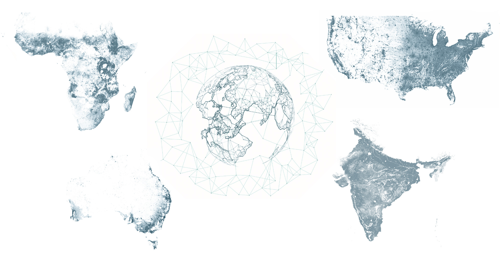
Together, Ecopia and Vantor have completed ambitious and unprecedented mapping projects around the world.
When Ecopia and Vantor first partnered in 2015, the goal was straightforward: produce the first complete map of building footprints across all of Australia. Leveraging Vantor’s high-resolution satellite imagery and Ecopia’s AI-based mapping systems, the two organizations extracted 20 million building footprints across 7.6M+ square kilometers in just a few months, a milestone that demonstrated what automated, AI-driven feature extraction could achieve at continental scale.
That success set the stage for continued expansion and efficiency gains. Building on the Australia project, Ecopia and Vantor went on to produce the first and only complete map of buildings across the United States, extracting 169 million building footprints in the same timeframe it had taken to map Australia’s 20 million. From there, the partnership continued to scale globally, with extractions completed across every inhabited continent. Notably, the Digitize Africa initiative mapped all 416 million buildings and 17 million kilometers of roads across 51 data-scarce African countries in just eight months, demonstrating that the combination of Vantor’s global satellite coverage and Ecopia’s GeoAI engine could close geospatial data gaps that had persisted for decades.
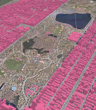
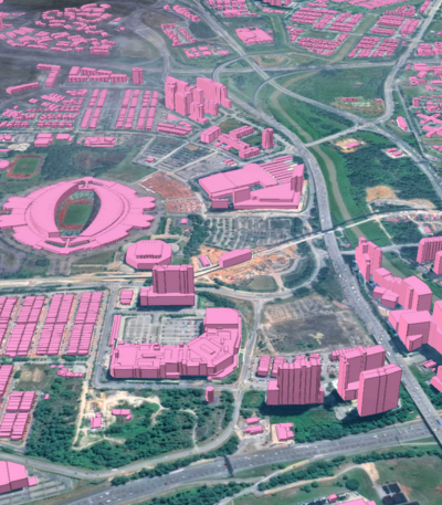
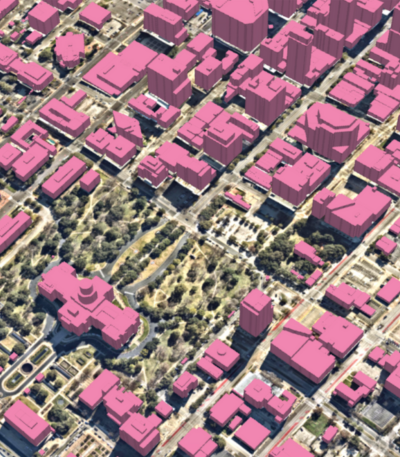
Today, the partnership has entered a new era. Ecopia 3D Land Cover Powered by Vantor symbolizes a landmark expansion of our joint capabilities, launching the most comprehensive, high-precision mapping data ever created and a commitment to produce more than one billion features globally. This dataset is already in active use by US and international government organizations as well as the private sector for basemapping, change detection, land use planning, public safety, and other geospatial intelligence applications.
Ecopia 3D Land Cover Powered by Vantor
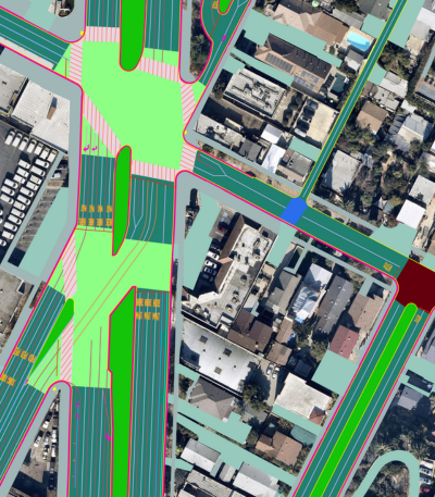
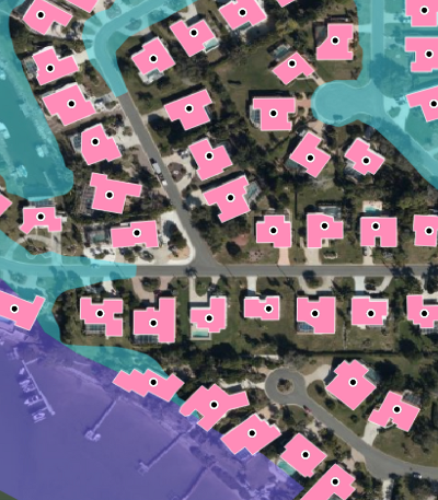
Ecopia 3D Land Cover Powered by Vantor addresses one of the most persistent challenges in the geospatial industry: the ability to create and maintain large-scale, standardized, interoperable, and high-precision vector map data anywhere in the world efficiently and cost-effectively.
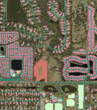
To do this, Ecopia’s AI map engine extracts vector features with greater than 95% geometric accuracy from Vantor’s satellite imagery archive, producing data for buildings, roads, and other land cover layers across a standardized global schema. This standardization ensures that data is consistent and comparable across geographies, enabling reliable analytics, cross-border comparisons, and repeatable workflows at national and continental scales.
[slider]


A sample of land cover data extracted by Ecopia from Vantor imagery in Nomzamo, South Africa.
What makes this offering uniquely powerful is how it handles sensor alignment and data currency over time. As Vantor’s constellation of satellites captures new imagery daily, the corresponding map data is kept aligned across sensors and acquisition dates through Vantor’s automated spatial fusion process. This process co-registers all imagery to a globally consistent 3D spatial foundation, ensuring that every extracted feature inherits the same geometric reference. The result is that when basemaps are updated with the latest imagery, features do not “drift,” but remain anchored to their true real-world locations. This eliminates a chronic problem in large-scale mapping workflows and makes long-term change detection and trend analysis reliable in a way that was not previously achievable at global scale.
For example, Vantor and Ecopia recently delivered more than 300 million 2D and 3D building vectors across India’s non-urban regions, an undermapped region covering approximately 3 million square kilometers, to a global mapping customer in just three months. With manual methods, a project of this scope would have taken many years. Because the source imagery was spatially fused prior to extraction, every feature in the resulting dataset was geometrically consistent, immediately interoperable with other map layers, and ready for direct integration into visualization, analytics, and decision-making workflows.
Enabling geospatial intelligence across industries and applications
The datasets produced through the Ecopia and Vantor partnership support a wide range of applications, from continuously updated global basemaps and infrastructure analysis to humanitarian logistics. Whether the need comes from a municipal government, an aid organization, or a technology company, the accuracy, consistency, and scalability of the dataset make it equally suited to each industry. The underlying value is the same across every use case: reliable, current, and precise geospatial intelligence at any scale.
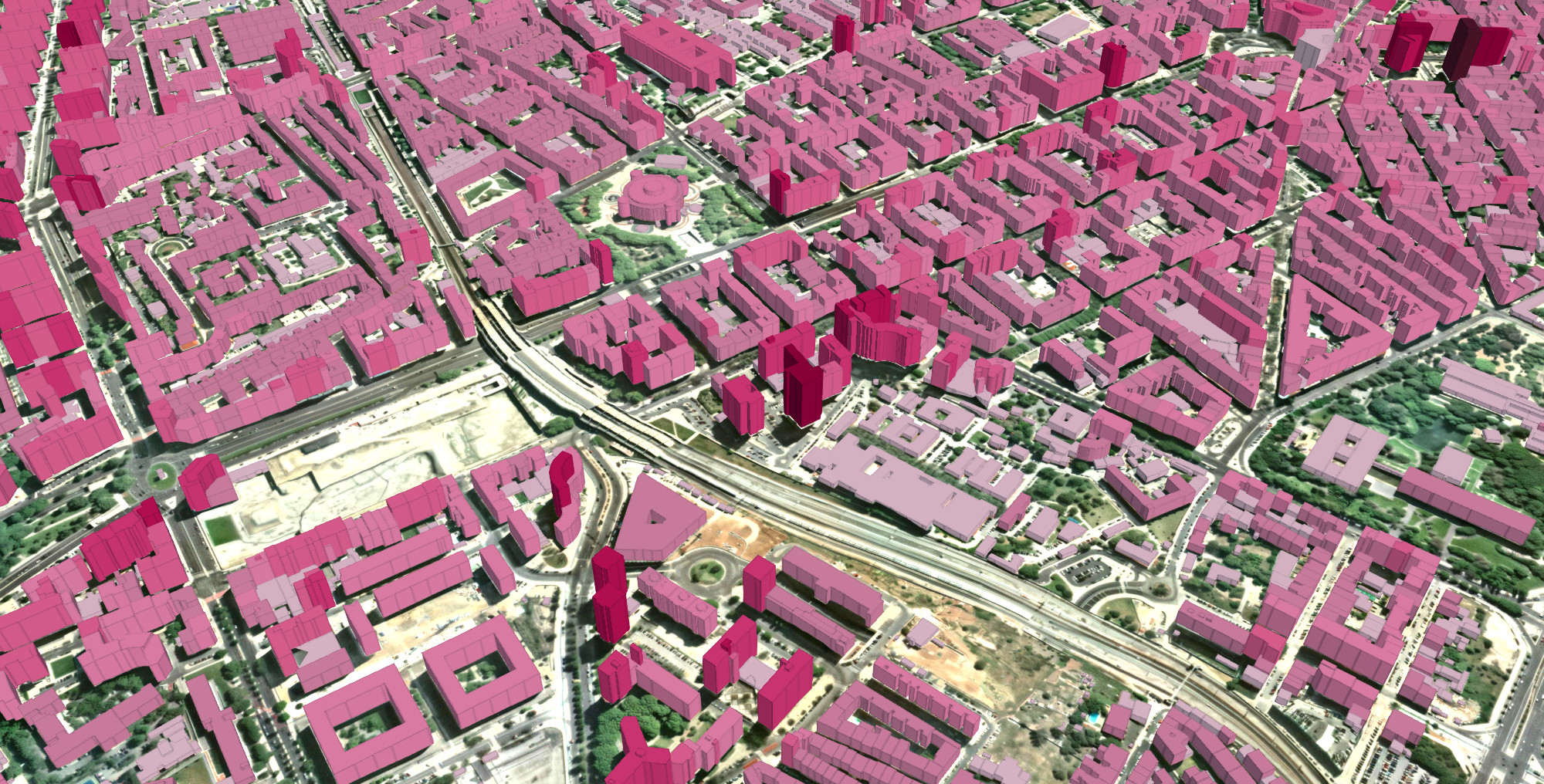
Global basemapping and digital twin development
For organizations building or maintaining global basemaps and digital twin platforms, Ecopia 3D Land Cover Powered by Vantor provides the vector foundation necessary to represent the built environment in detail, anywhere on Earth. The combination of broad geographic coverage, standardized data schema, and alignment across sensors and time enables organizations to build and update basemaps and digital twins that accurately reflect real-world conditions, from individual buildings to entire continents.
Humanitarian aid
The partnership’s origins in large-scale humanitarian mapping reflect a deep commitment to expanding geospatial data access in underserved regions and ensuring field crews can reach communities that have never before appeared on a map. Ecopia 3D Land Cover Powered by Vantor provides the geospatial insights humanitarian organizations need to optimize vaccine distribution routes, plan public health services, and ensure that no settlement is missed.
Urban planning, infrastructure, and public safety
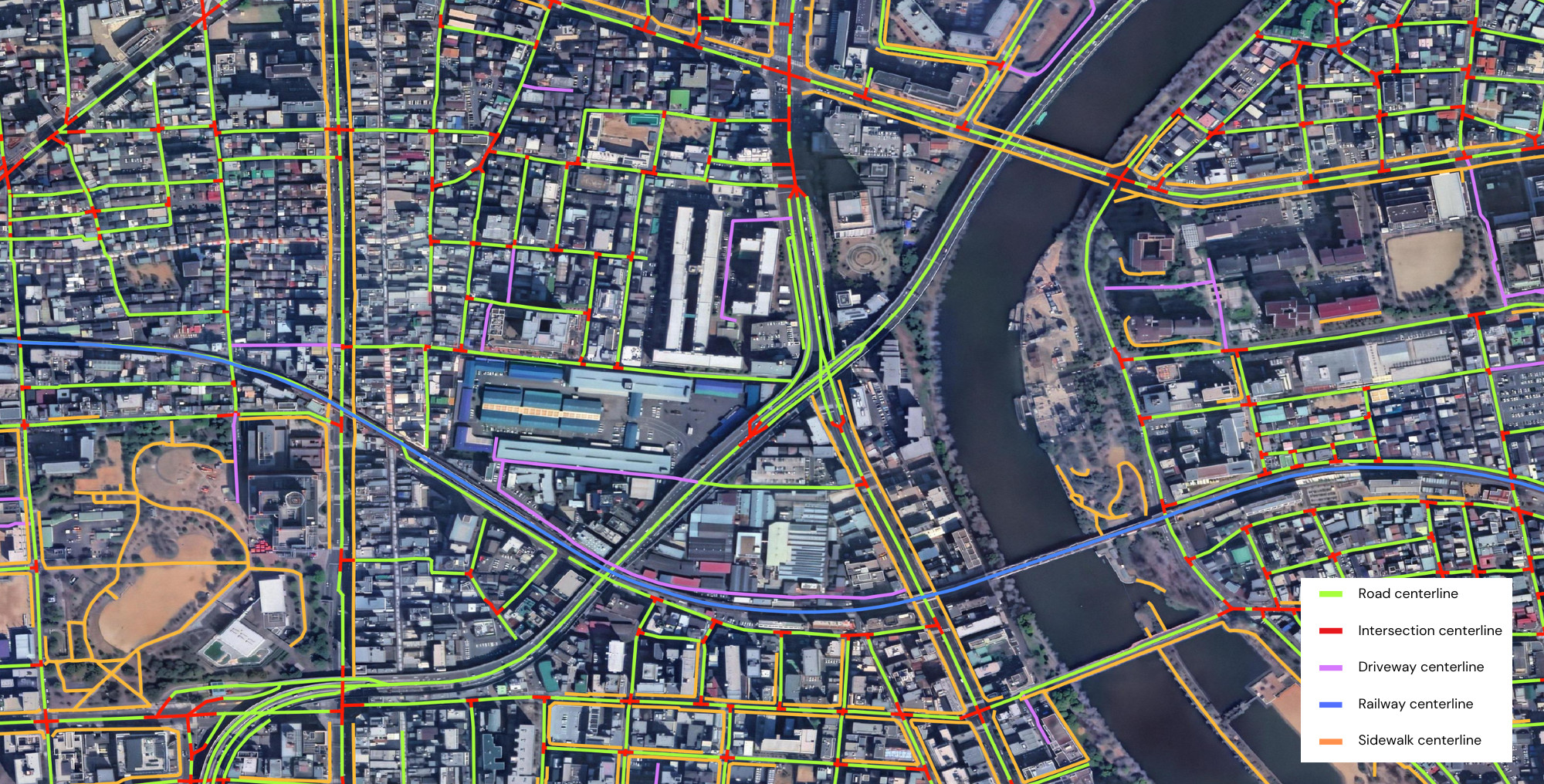
Accurate, current vector data is foundational for a variety of public sector initiatives. Both US and international government organizations are leveraging Ecopia 3D Land Cover Powered by Vantor for geospatial workflows, including basemapping, change detection, land use planning, and public safety applications. From powering routing applications to tracking land use change to enabling better-informed decisions about infrastructure investment, environmental protection, and hazard mitigation, the data’s high geometric accuracy, consistent global schema, and ability to be efficiently updated with the latest imagery make it well-suited for mission-critical applications where data quality and currency are paramount.
Learn more about Ecopia’s partnership with Vantor
From 20 million buildings in Australia to more than a billion features globally, the Ecopia and Vantor partnership has consistently pushed the boundary of what GeoAI can achieve. Together, we are delivering the accuracy, scale, and currency that organizations need to understand our changing planet and make confident, data-driven decisions.
To learn more or request a demo, get in touch with Ecopia’s team.
–
About Vantor
Vantor is forging the new frontier of spatial intelligence, empowering nations and global businesses with the power to command the ground truth from space to ground. We integrate our trusted intelligence, sovereign control, and AI-powered capabilities to build a unified picture of what’s happening on Earth and in space. Fueled by the Vantor imaging satellite constellation, Vantor’s Tensorglobe platform orchestrates the full spatial intelligence cycle—from tasking and fusion to analysis and delivery—anchoring real-time data from space, air and ground to Vantor’s uniquely accurate, AI-ready spatial foundation. With this combination of hardware, data, and operational software, Vantor supports the missions that matter most, from real-time mapmaking and GEOINT analysis to tactical operations, persistent monitoring and autonomy. Learn more at www.vantor.com.
About Ecopia AI
Ecopia is on a mission to create a digital twin of the Earth. We leverage artificial intelligence to convert high-resolution imagery into high-precision 3D vector map data at scale. This data creates a digital representation of the physical world, forming the foundation of a digital twin for visualization, analytics, and decision-making. Ecopia’s data is leveraged by hundreds of commercial and government organizations across more than 100 countries around the world.
Learn more about Ecopia's global partner network

Ready to get started?
