
Powering Smarter Sidewalk Inspections with DeepWalk and Ecopia AI
See how DeepWalk uses Ecopia AI sidewalk data to plan inspections, estimate costs, and correct GPS drift for municipalities across Illinois.

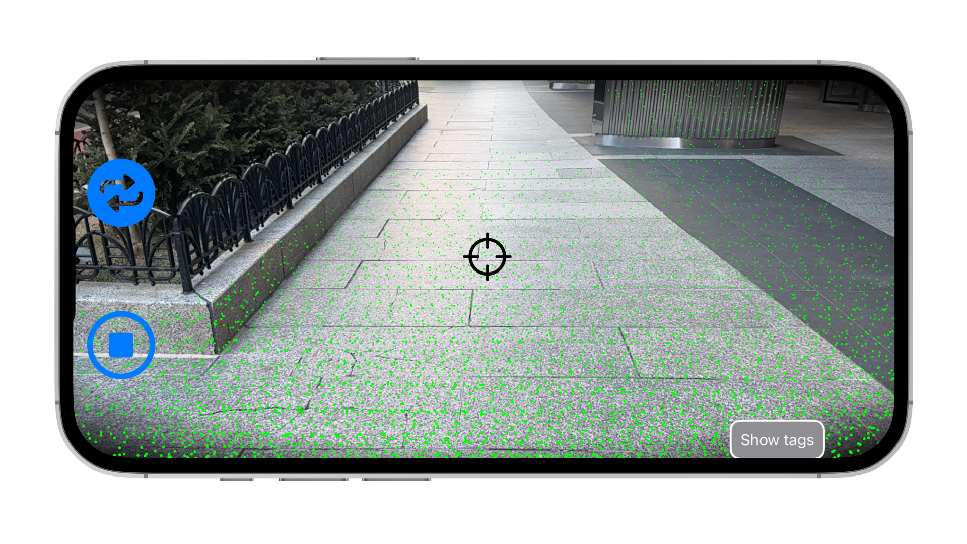
Municipalities, universities, and state departments of transportation (DOTs) are increasingly turning to automated tools to keep their sidewalk networks safe and accessible. DeepWalk, a Chicago-based firm used by roughly 130 organizations across the country, has built one of the leading platforms for this work, using the LiDAR scanners built into iPhones to capture detailed condition data on sidewalks and curb ramps.
DeepWalk’s core focus is connecting two workflows that are often kept separate: accessibility-focused inspections and the annual maintenance work that follows. “We think it’s really important that those two are connected, because often they’re weirdly disconnected,” said Brandon Yates, Co-Founder & CEO of DeepWalk. When an inspection flags an access barrier, DeepWalk delivers that finding in a format the maintenance crew can act on directly. Underneath many of those inspections is a layer of data built by Ecopia AI (Ecopia).
The challenge
Before a municipality can plan a sidewalk condition assessment, it needs to answer a basic question: how much sidewalk does it actually have, and where is it? That question is harder to answer than it sounds. Many public works departments are working from datasets that were collected manually years ago and never kept current. Others rely on OpenStreetMap, which depends entirely on volunteer mapping activity. Coverage can be strong in one city and nearly nonexistent in the next, with no reliable way to know which is true before starting a project.
Once a collection project is underway, field teams also need to know exactly where to send crews and how to organize the work. Without a reliable base layer, that planning is done by hand. And because DeepWalk’s inspections are captured using an iPhone’s GPS, the resulting data can drift in dense urban areas, producing sidewalk lines that don’t line up cleanly with a community’s existing assets.
“A lot of our customers don’t know how much sidewalk they have,” said Yates. Existing datasets are often a decade old and far less detailed than what’s needed to plan a project with confidence.
Open data sources don’t reliably fill the gap, either. “If you don’t have a community that cares about mapping a place, you don’t have OpenStreetMap data for it,” Yates said.
The solution
DeepWalk’s relationship with Ecopia’s data started in Illinois, where Ecopia built out a sidewalk layer in partnership with the Chicago Metropolitan Agency for Planning (CMAP) and other regional transportation groups. Many of DeepWalk’s Illinois customers already had access to that dataset. Manually collected sidewalk inventories exist in some communities, but “it’s nowhere near the granularity of what we saw with Ecopia,” Yates said. DeepWalk found three practical ways to put that data to work:
- Scoping and cost estimation. Ecopia’s sidewalk layer gives DeepWalk’s customers an accurate read on how much sidewalk sits within their network before a collection project starts, replacing outdated manual counts and making it possible to estimate project cost and timeline with confidence.
- Planning field collection. Rather than drawing collection routes by hand or relying on inconsistent OpenStreetMap coverage, DeepWalk loads Ecopia’s sidewalk data directly into its platform. “We load Ecopia data into DeepWalk so our customers can see exactly where the sidewalk is and assign crews to go do the collection,” Yates said.
- Correcting GPS drift. When a customer already has an Ecopia sidewalk layer they trust, DeepWalk projects its collected LiDAR data onto those existing lines. This snaps the newly captured condition data into alignment with the community’s established assets, correcting for the GPS drift that can occur in dense areas.
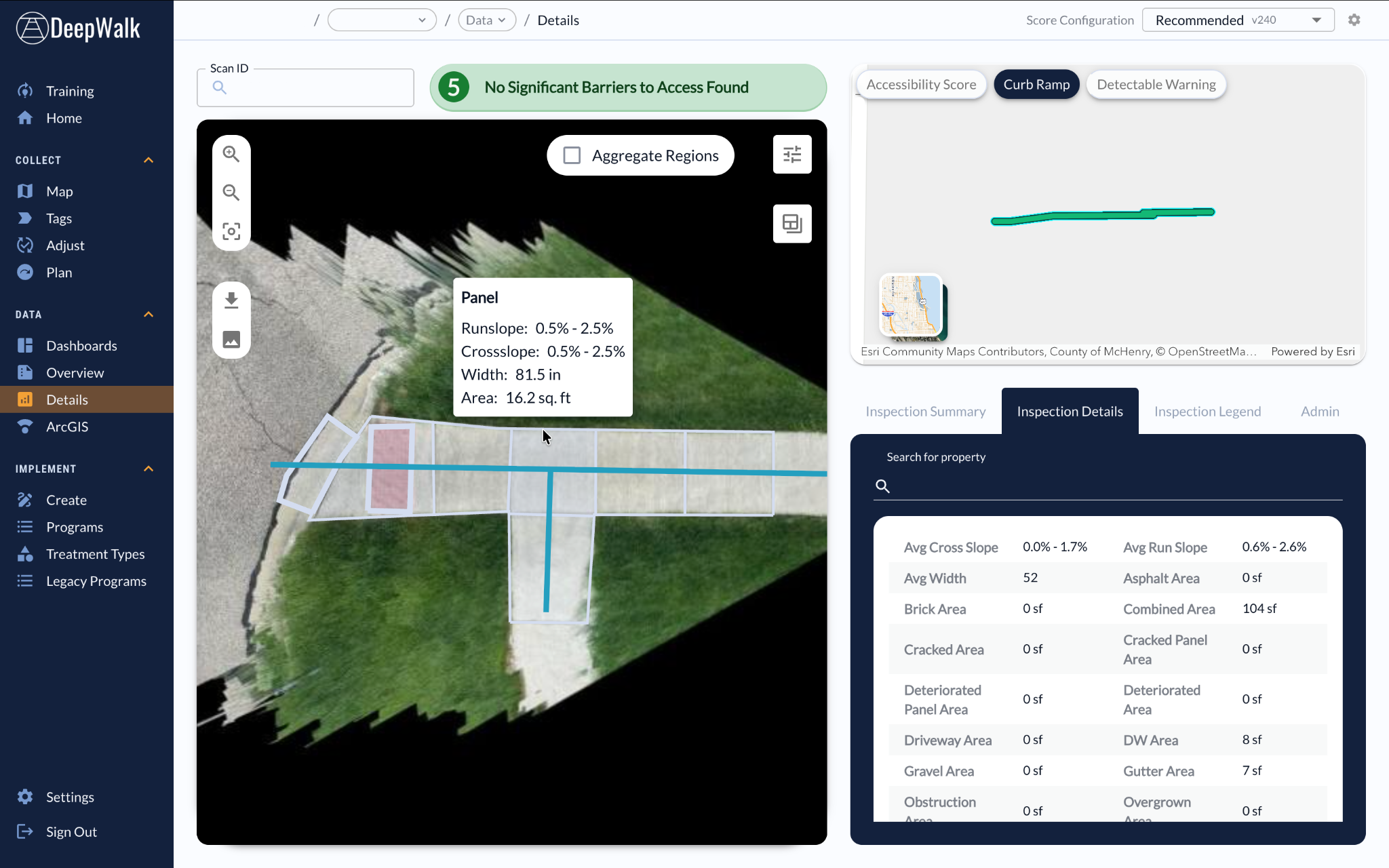
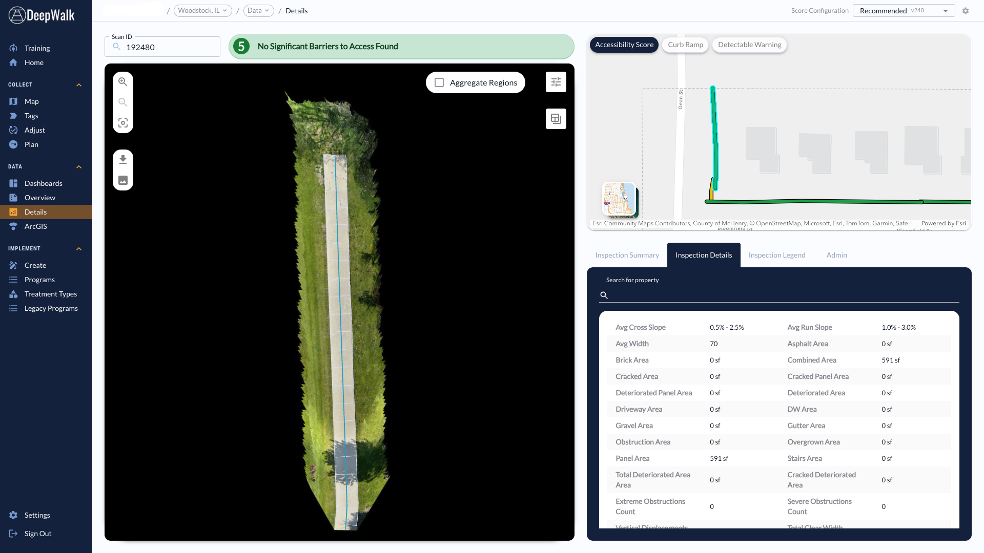
Woodstock, Illinois: Ecopia data at both ends of the project
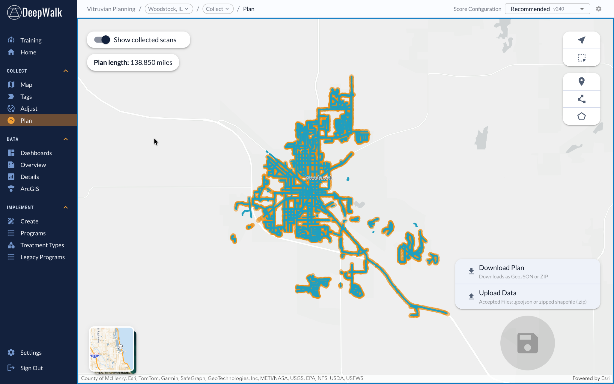
Woodstock, IL, is one example of this working end to end. As a CMAP-led project, Woodstock was provided with Ecopia’s sidewalk line layer at the project’s kickoff, giving DeepWalk a starting map of the city’s 138.85-mile sidewalk network.
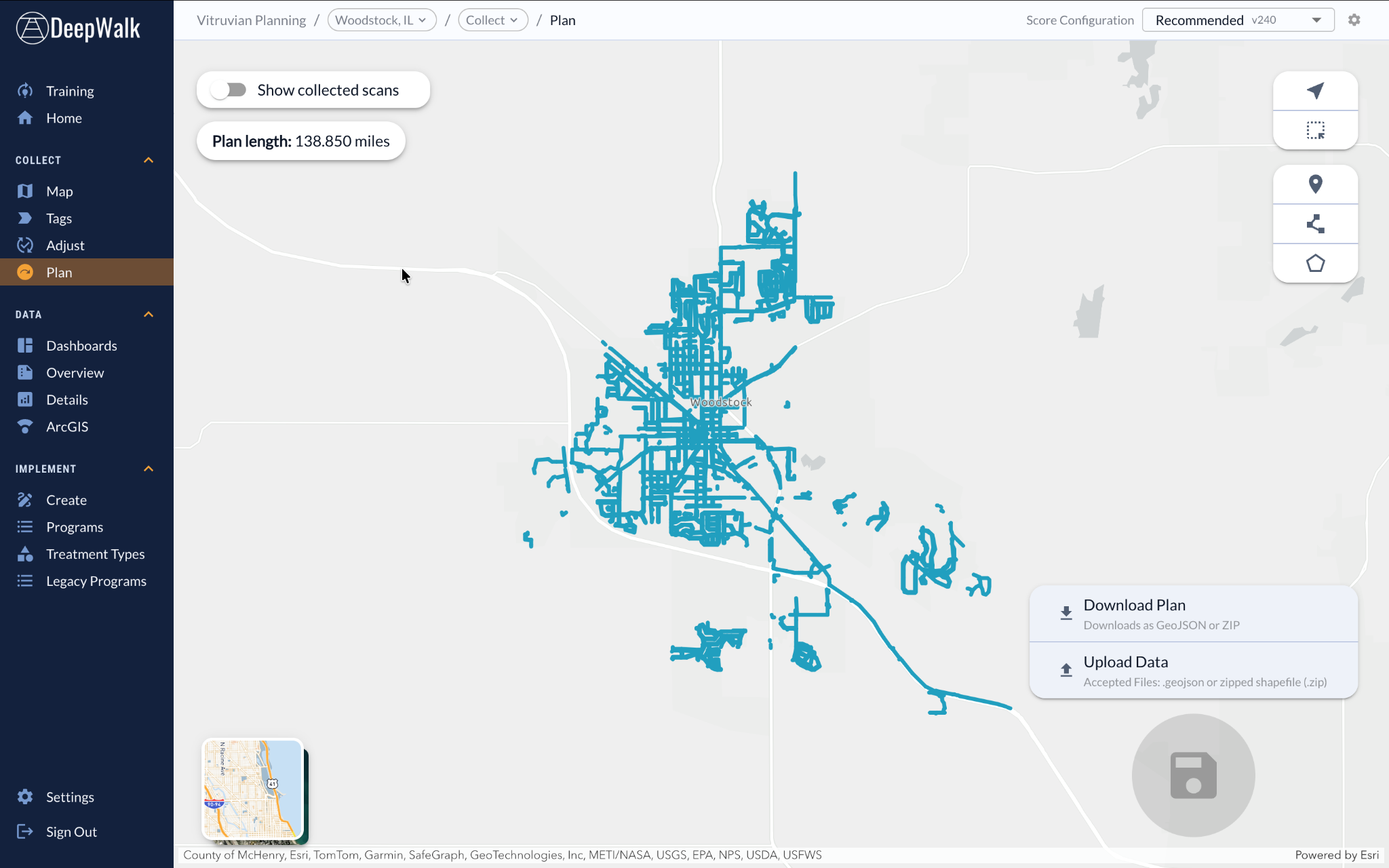
At the end of the project, DeepWalk projected its newly collected condition data back on top of that same Ecopia layer, aligning the finished dataset with the city’s source of truth.

The result
By building on Ecopia’s sidewalk data instead of starting from scratch, DeepWalk’s customers get a faster, more confident start to their sidewalk condition assessments: a clear picture of the scope of work ahead of time, a reliable base map for directing field crews, and a finished dataset that lines up with the assets they already manage. Because Ecopia’s data was created once, centrally, through the CMAP partnership, that same foundation is available to every contractor working across Illinois, DeepWalk included, rather than each organization recreating it independently.
What’s next
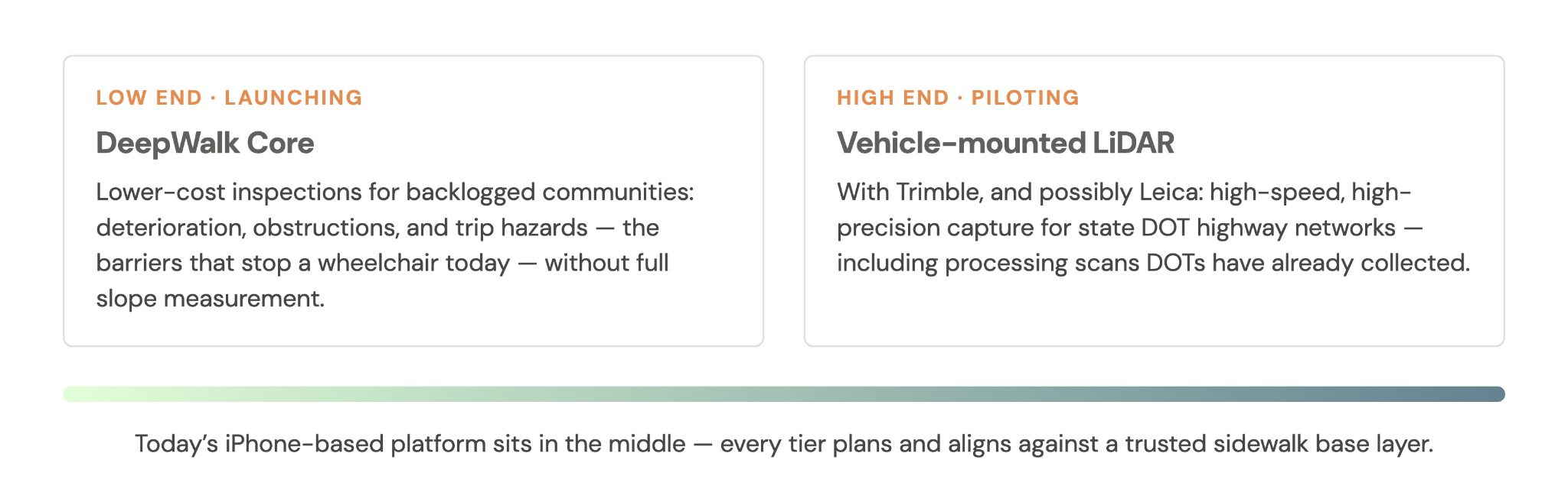
DeepWalk’s next moves follow one deliberate strategy: building out both ends of the spectrum, from low-budget communities working through a maintenance backlog to well-funded agencies chasing precision.
On the low end, DeepWalk launched DeepWalk Core in March 2026, a lower-cost offering focused on the access barriers that matter most to a backlogged community: deterioration, obstructions, and trip hazards, rather than full slope measurement. Slope is expensive to capture accurately — it requires heavy quality control, and it can’t be measured from a moving vehicle.
“You can’t put the phone on a bike and take a slope measurement. It’s just moving too fast,” Yates said. And for many communities, slope isn’t the most urgent problem anyway. “If there’s a bush covering the sidewalk, it doesn’t matter what the slope is — if you’re in a wheelchair, you can’t get through it. Or if there’s a two-inch trip hazard, it doesn’t matter if it’s steep,” he said. “We had one product that did accessibility prioritization and maintenance work,” he added. “We split that into a low-cost maintenance offering and a higher-cost, higher-precision accessibility prioritization option.”
The company has also automated trip hazard detection, and after comparing its results against years of manually tagged data, has found it consistently catches hazards that manual review missed.
On the high end, DeepWalk is piloting inspections captured through car-mounted LiDAR scanners, working with Trimble and Leica, a higher-precision option suited to large, high-speed projects like state DOT highway networks. “A good chunk of DOTs have already scanned their highways, and we have the ability to just go process data they’ve already collected,” Yates said.
DeepWalk is also looking to grow its use of Ecopia data beyond Illinois. With Ecopia’s sidewalk datasets available across the country, and DeepWalk already operating in 30 states, the two companies see room to extend this partnership to more of the communities DeepWalk serves. “It just makes our life a lot easier, and it makes our deliverables better,” Yates said of expanding the partnership beyond Illinois.
To learn more about how Ecopia AI is supporting civil engineering and transportation planning, get in touch with our team and explore our data portal.
Related reading
- Scaling Regional Planning Data Creation with AI Mapping
- Supporting Active Transportation Planning in Mt. Shasta with Alta
- Maintaining a Current Bike & Pedestrian Data Inventory for Active Transportation Planning
- Improving Transportation Safety, Accessibility, & Sustainability with High-Precision Mapping Data
Ready to get started?
